You are here: Home > Network List > US - United States National Seismic Network Stations List
> Station MIAR Mount Ida, Arkansas, USA > Earthquake Result Viewer
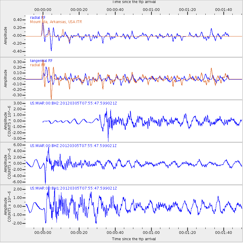
MIAR Mount Ida, Arkansas, USA - Earthquake Result Viewer
*The percent match for this event was below the threshold and hence no stack was calculated.
| Earthquake location: |
Santiago Del Estero Prov., Arg. |
| Earthquake latitude/longitude: |
-28.2/-63.3 |
| Earthquake time(UTC): |
2012/03/05 (065) 07:46:10 GMT |
| Earthquake Depth: |
554 km |
| Earthquake Magnitude: |
6.0 MB, 6.1 MW, 6.1 MW |
| Earthquake Catalog/Contributor: |
WHDF/NEIC |
|
| Network: |
US United States National Seismic Network |
| Station: |
MIAR Mount Ida, Arkansas, USA |
| Lat/Lon: |
34.55 N/93.58 W |
| Elevation: |
207 m |
|
| Distance: |
68.7 deg |
| Az: |
333.465 deg |
| Baz: |
151.479 deg |
| Ray Param: |
$rayparam |
*The percent match for this event was below the threshold and hence was not used in the summary stack. |
|
| Radial Match: |
73.51477 % |
| Radial Bump: |
400 |
| Transverse Match: |
71.24592 % |
| Transverse Bump: |
400 |
| SOD ConfigId: |
558545 |
| Insert Time: |
2013-09-19 13:09:27.603 +0000 |
| GWidth: |
2.5 |
| Max Bumps: |
400 |
| Tol: |
0.001 |
|
Signal To Noise
| Channel | StoN | STA | LTA |
| US:MIAR:00:BHZ:20120305T07:55:47.599021Z | 3.707449 | 2.2663999E-6 | 6.1130976E-7 |
| US:MIAR:00:BH1:20120305T07:55:47.599021Z | 2.3379629 | 1.0278205E-6 | 4.3962226E-7 |
| US:MIAR:00:BH2:20120305T07:55:47.599021Z | 3.9461017 | 7.8873205E-7 | 1.9987627E-7 |
| Arrivals |
| Ps | |
| PpPs | |
| PsPs/PpSs | |


