You are here: Home > Network List > US - United States National Seismic Network Stations List
> Station MSO Missoula, Montana, USA > Earthquake Result Viewer
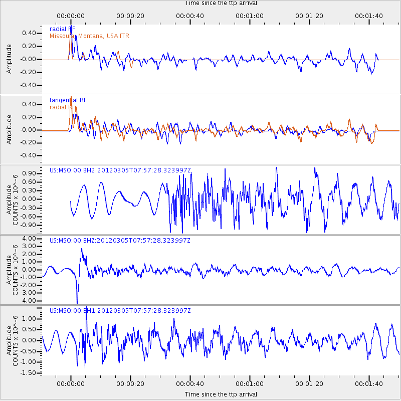
MSO Missoula, Montana, USA - Earthquake Result Viewer
*The percent match for this event was below the threshold and hence no stack was calculated.
| Earthquake location: |
Santiago Del Estero Prov., Arg. |
| Earthquake latitude/longitude: |
-28.2/-63.3 |
| Earthquake time(UTC): |
2012/03/05 (065) 07:46:10 GMT |
| Earthquake Depth: |
554 km |
| Earthquake Magnitude: |
6.0 MB, 6.1 MW, 6.1 MW |
| Earthquake Catalog/Contributor: |
WHDF/NEIC |
|
| Network: |
US United States National Seismic Network |
| Station: |
MSO Missoula, Montana, USA |
| Lat/Lon: |
46.83 N/113.94 W |
| Elevation: |
1264 m |
|
| Distance: |
87.6 deg |
| Az: |
327.9 deg |
| Baz: |
136.938 deg |
| Ray Param: |
$rayparam |
*The percent match for this event was below the threshold and hence was not used in the summary stack. |
|
| Radial Match: |
57.65019 % |
| Radial Bump: |
400 |
| Transverse Match: |
67.087845 % |
| Transverse Bump: |
400 |
| SOD ConfigId: |
558545 |
| Insert Time: |
2013-09-19 13:09:33.350 +0000 |
| GWidth: |
2.5 |
| Max Bumps: |
400 |
| Tol: |
0.001 |
|
Signal To Noise
| Channel | StoN | STA | LTA |
| US:MSO:00:BHZ:20120305T07:57:28.323997Z | 4.076076 | 1.6003671E-6 | 3.9262446E-7 |
| US:MSO:00:BH1:20120305T07:57:28.323997Z | 0.95626944 | 4.722744E-7 | 4.9387165E-7 |
| US:MSO:00:BH2:20120305T07:57:28.323997Z | 1.4000295 | 4.557332E-7 | 3.2551682E-7 |
| Arrivals |
| Ps | |
| PpPs | |
| PsPs/PpSs | |


