You are here: Home > Network List > II - Global Seismograph Network (GSN - IRIS/IDA) Stations List
> Station WRAB Tennant Creek, NT, Australia > Earthquake Result Viewer
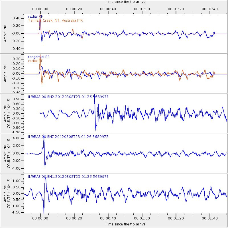
WRAB Tennant Creek, NT, Australia - Earthquake Result Viewer
*The percent match for this event was below the threshold and hence no stack was calculated.
| Earthquake location: |
Southern Xinjiang, China |
| Earthquake latitude/longitude: |
39.4/81.3 |
| Earthquake time(UTC): |
2012/03/08 (068) 22:50:08 GMT |
| Earthquake Depth: |
38 km |
| Earthquake Magnitude: |
5.8 MB, 5.6 MS, 5.9 MW, 5.8 MW |
| Earthquake Catalog/Contributor: |
WHDF/NEIC |
|
| Network: |
II Global Seismograph Network (GSN - IRIS/IDA) |
| Station: |
WRAB Tennant Creek, NT, Australia |
| Lat/Lon: |
19.93 S/134.36 E |
| Elevation: |
366 m |
|
| Distance: |
77.1 deg |
| Az: |
129.51 deg |
| Baz: |
320.54 deg |
| Ray Param: |
$rayparam |
*The percent match for this event was below the threshold and hence was not used in the summary stack. |
|
| Radial Match: |
66.282974 % |
| Radial Bump: |
400 |
| Transverse Match: |
55.637978 % |
| Transverse Bump: |
400 |
| SOD ConfigId: |
558545 |
| Insert Time: |
2013-09-19 13:20:48.379 +0000 |
| GWidth: |
2.5 |
| Max Bumps: |
400 |
| Tol: |
0.001 |
|
Signal To Noise
| Channel | StoN | STA | LTA |
| II:WRAB:00:BHZ:20120308T23:01:26.568997Z | 11.345285 | 1.7412345E-6 | 1.5347649E-7 |
| II:WRAB:00:BH1:20120308T23:01:26.568997Z | 4.3032856 | 6.309343E-7 | 1.4661688E-7 |
| II:WRAB:00:BH2:20120308T23:01:26.568997Z | 3.332118 | 5.07468E-7 | 1.5229593E-7 |
| Arrivals |
| Ps | |
| PpPs | |
| PsPs/PpSs | |


