You are here: Home > Network List > US - United States National Seismic Network Stations List
> Station HAWA Hanford, Washington, USA > Earthquake Result Viewer
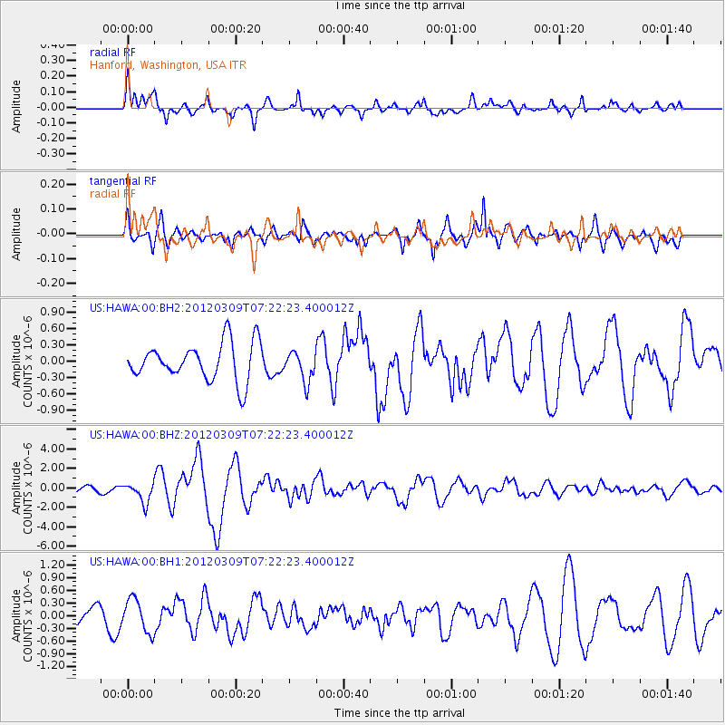
HAWA Hanford, Washington, USA - Earthquake Result Viewer
*The percent match for this event was below the threshold and hence no stack was calculated.
| Earthquake location: |
Vanuatu Islands |
| Earthquake latitude/longitude: |
-19.1/169.6 |
| Earthquake time(UTC): |
2012/03/09 (069) 07:09:50 GMT |
| Earthquake Depth: |
16 km |
| Earthquake Magnitude: |
6.1 MB, 6.7 MS, 6.7 MW, 6.7 MW |
| Earthquake Catalog/Contributor: |
WHDF/NEIC |
|
| Network: |
US United States National Seismic Network |
| Station: |
HAWA Hanford, Washington, USA |
| Lat/Lon: |
46.39 N/119.53 W |
| Elevation: |
364 m |
|
| Distance: |
91.2 deg |
| Az: |
40.843 deg |
| Baz: |
243.3 deg |
| Ray Param: |
$rayparam |
*The percent match for this event was below the threshold and hence was not used in the summary stack. |
|
| Radial Match: |
78.636154 % |
| Radial Bump: |
400 |
| Transverse Match: |
79.522385 % |
| Transverse Bump: |
400 |
| SOD ConfigId: |
558545 |
| Insert Time: |
2013-09-19 13:24:56.248 +0000 |
| GWidth: |
2.5 |
| Max Bumps: |
400 |
| Tol: |
0.001 |
|
Signal To Noise
| Channel | StoN | STA | LTA |
| US:HAWA:00:BHZ:20120309T07:22:23.400012Z | 2.8672912 | 1.0068441E-6 | 3.511482E-7 |
| US:HAWA:00:BH1:20120309T07:22:23.400012Z | 2.31857 | 3.971794E-7 | 1.7130361E-7 |
| US:HAWA:00:BH2:20120309T07:22:23.400012Z | 0.80745727 | 2.777229E-7 | 3.4394748E-7 |
| Arrivals |
| Ps | |
| PpPs | |
| PsPs/PpSs | |


