You are here: Home > Network List > US - United States National Seismic Network Stations List
> Station HDIL Hopedale, Illinois, USA > Earthquake Result Viewer
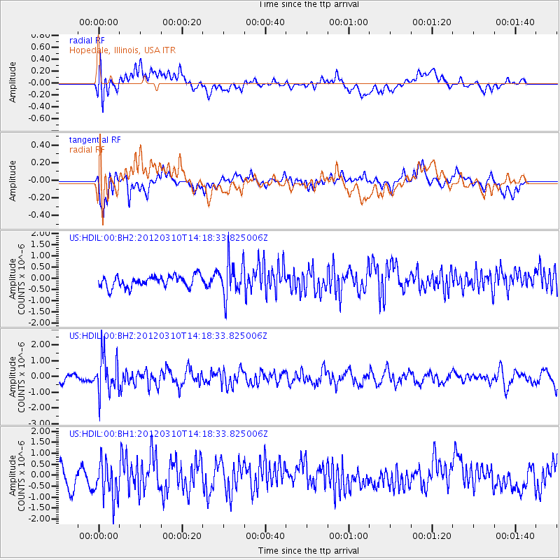
HDIL Hopedale, Illinois, USA - Earthquake Result Viewer
*The percent match for this event was below the threshold and hence no stack was calculated.
| Earthquake location: |
Alaska Peninsula |
| Earthquake latitude/longitude: |
55.1/-157.6 |
| Earthquake time(UTC): |
2012/03/10 (070) 14:10:39 GMT |
| Earthquake Depth: |
10 km |
| Earthquake Magnitude: |
5.5 MW, 5.7 MB |
| Earthquake Catalog/Contributor: |
NEIC PDE/NEIC PDE-M |
|
| Network: |
US United States National Seismic Network |
| Station: |
HDIL Hopedale, Illinois, USA |
| Lat/Lon: |
40.56 N/89.29 W |
| Elevation: |
219 m |
|
| Distance: |
46.2 deg |
| Az: |
78.744 deg |
| Baz: |
312.357 deg |
| Ray Param: |
$rayparam |
*The percent match for this event was below the threshold and hence was not used in the summary stack. |
|
| Radial Match: |
41.439243 % |
| Radial Bump: |
400 |
| Transverse Match: |
53.813854 % |
| Transverse Bump: |
400 |
| SOD ConfigId: |
558545 |
| Insert Time: |
2013-09-19 13:27:30.226 +0000 |
| GWidth: |
2.5 |
| Max Bumps: |
400 |
| Tol: |
0.001 |
|
Signal To Noise
| Channel | StoN | STA | LTA |
| US:HDIL:00:BHZ:20120310T14:18:33.825006Z | 3.0131764 | 1.2089002E-6 | 4.012046E-7 |
| US:HDIL:00:BH1:20120310T14:18:33.825006Z | 1.6010722 | 8.5089204E-7 | 5.314514E-7 |
| US:HDIL:00:BH2:20120310T14:18:33.825006Z | 3.105375 | 7.9315953E-7 | 2.5541507E-7 |
| Arrivals |
| Ps | |
| PpPs | |
| PsPs/PpSs | |


