You are here: Home > Network List > US - United States National Seismic Network Stations List
> Station MNTX Cornudas Mountains, Texas, USA > Earthquake Result Viewer
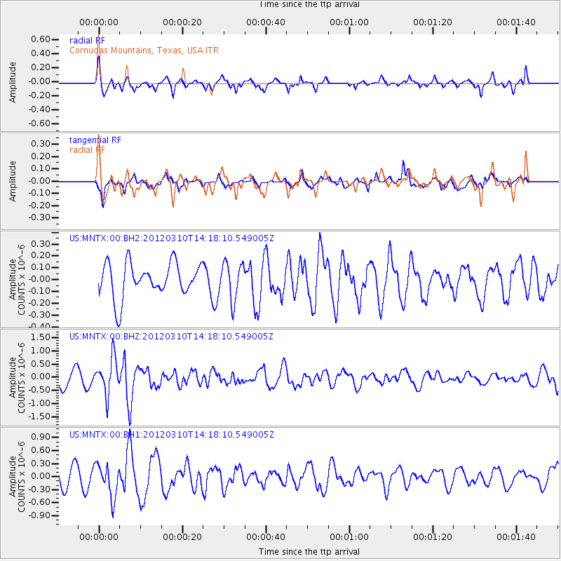
MNTX Cornudas Mountains, Texas, USA - Earthquake Result Viewer
*The percent match for this event was below the threshold and hence no stack was calculated.
| Earthquake location: |
Alaska Peninsula |
| Earthquake latitude/longitude: |
55.1/-157.6 |
| Earthquake time(UTC): |
2012/03/10 (070) 14:10:39 GMT |
| Earthquake Depth: |
10 km |
| Earthquake Magnitude: |
5.5 MW, 5.7 MB |
| Earthquake Catalog/Contributor: |
NEIC PDE/NEIC PDE-M |
|
| Network: |
US United States National Seismic Network |
| Station: |
MNTX Cornudas Mountains, Texas, USA |
| Lat/Lon: |
31.70 N/105.38 W |
| Elevation: |
404 m |
|
| Distance: |
43.3 deg |
| Az: |
100.741 deg |
| Baz: |
318.572 deg |
| Ray Param: |
$rayparam |
*The percent match for this event was below the threshold and hence was not used in the summary stack. |
|
| Radial Match: |
61.547306 % |
| Radial Bump: |
362 |
| Transverse Match: |
62.017506 % |
| Transverse Bump: |
397 |
| SOD ConfigId: |
558545 |
| Insert Time: |
2013-09-19 13:27:48.118 +0000 |
| GWidth: |
2.5 |
| Max Bumps: |
400 |
| Tol: |
0.001 |
|
Signal To Noise
| Channel | StoN | STA | LTA |
| US:MNTX:00:BHZ:20120310T14:18:10.549005Z | 2.724425 | 6.9228247E-7 | 2.5410222E-7 |
| US:MNTX:00:BH1:20120310T14:18:10.549005Z | 1.8957403 | 3.832694E-7 | 2.02174E-7 |
| US:MNTX:00:BH2:20120310T14:18:10.549005Z | 1.1089965 | 1.5791807E-7 | 1.4239725E-7 |
| Arrivals |
| Ps | |
| PpPs | |
| PsPs/PpSs | |


