You are here: Home > Network List > US - United States National Seismic Network Stations List
> Station AMTX Amarillo, Texas, USA > Earthquake Result Viewer
AMTX Amarillo, Texas, USA - Earthquake Result Viewer
*The percent match for this event was below the threshold and hence no stack was calculated.
| Earthquake location: |
Kuril Islands |
| Earthquake latitude/longitude: |
45.2/147.6 |
| Earthquake time(UTC): |
2012/03/12 (072) 12:32:46 GMT |
| Earthquake Depth: |
110 km |
| Earthquake Magnitude: |
5.7 MB, 5.5 MW, 5.6 MW |
| Earthquake Catalog/Contributor: |
WHDF/NEIC |
|
| Network: |
US United States National Seismic Network |
| Station: |
AMTX Amarillo, Texas, USA |
| Lat/Lon: |
34.53 N/101.41 W |
| Elevation: |
1010 m |
|
| Distance: |
79.0 deg |
| Az: |
51.741 deg |
| Baz: |
317.78 deg |
| Ray Param: |
$rayparam |
*The percent match for this event was below the threshold and hence was not used in the summary stack. |
|
| Radial Match: |
47.744858 % |
| Radial Bump: |
400 |
| Transverse Match: |
61.870987 % |
| Transverse Bump: |
400 |
| SOD ConfigId: |
558545 |
| Insert Time: |
2013-09-19 13:34:07.574 +0000 |
| GWidth: |
2.5 |
| Max Bumps: |
400 |
| Tol: |
0.001 |
|
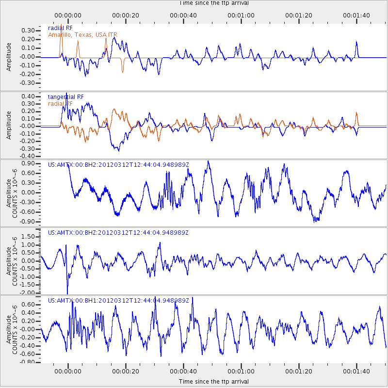
Signal To Noise
| Channel | StoN | STA | LTA |
| US:AMTX:00:BHZ:20120312T12:44:04.948989Z | 2.843219 | 7.6826507E-7 | 2.702096E-7 |
| US:AMTX:00:BH1:20120312T12:44:04.948989Z | 1.6735709 | 3.1669066E-7 | 1.892305E-7 |
| US:AMTX:00:BH2:20120312T12:44:04.948989Z | 1.1316699 | 3.1510342E-7 | 2.784411E-7 |
| Arrivals |
| Ps | |
| PpPs | |
| PsPs/PpSs | |


