
WRAB Tennant Creek, NT, Australia - Earthquake Result Viewer
| ||||||||||||||||||
| ||||||||||||||||||
| ||||||||||||||||||
|
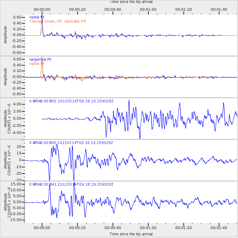
Signal To Noise
| Channel | StoN | STA | LTA |
| II:WRAB:00:BHZ:20120314T09:18:19.269028Z | 40.27539 | 9.571714E-6 | 2.3765665E-7 |
| II:WRAB:00:BH1:20120314T09:18:19.269028Z | 18.632618 | 4.8441534E-6 | 2.5998244E-7 |
| II:WRAB:00:BH2:20120314T09:18:19.269028Z | 6.51651 | 7.889546E-7 | 1.2107012E-7 |
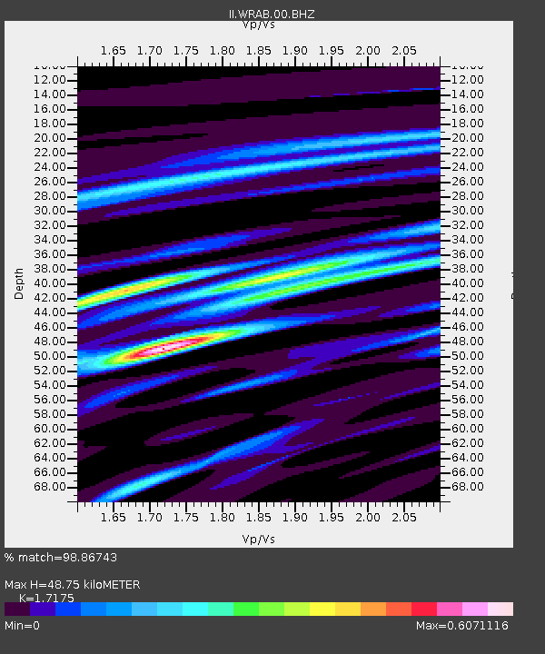
| Arrivals | |
| Ps | 5.5 SECOND |
| PpPs | 19 SECOND |
| PsPs/PpSs | 25 SECOND |

