KEV Kevo, Finland - Earthquake Result Viewer
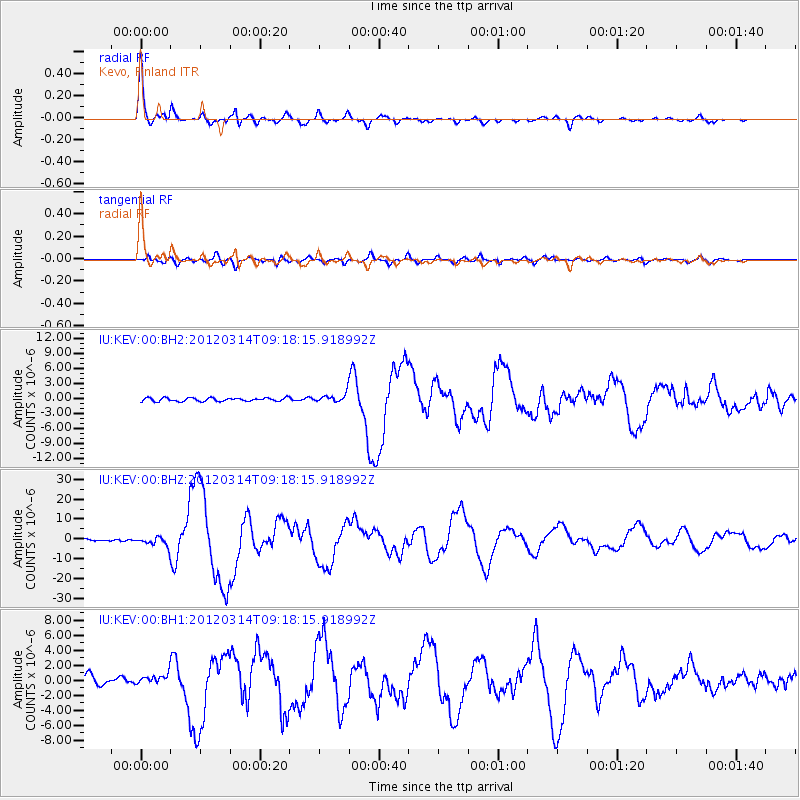
Earthquake location: Off East Coast Of Honshu, Japan
Earthquake latitude/longitude: 40.9/144.9
Earthquake time(UTC): 2012/03/14 (074) 09:08:35 GMT
Earthquake Depth: 12 km
Earthquake Magnitude: 6.7 MB, 6.9 MS, 6.9 MW, 7.0 MW
Earthquake Catalog/Contributor: WHDF/NEIC
Network: IU Global Seismograph Network (GSN - IRIS/USGS)
Station: KEV Kevo, Finland
Lat/Lon: 69.76 N/27.00 E
Elevation: 100 m
Distance: 60.8 deg
Az: 339.378 deg
Baz: 50.102 deg
Ray Param: 0.061278827
Estimated Moho Depth: 45.0 km
Estimated Crust Vp/Vs: 1.73
Assumed Crust Vp: 6.622 km/s
Estimated Crust Vs: 3.828 km/s
Estimated Crust Poisson's Ratio: 0.25
Radial Match: 96.87457 %
Radial Bump: 335
Transverse Match: 89.81751 %
Transverse Bump: 400
SOD ConfigId: 558545
Insert Time: 2013-09-19 13:40:12.879 +0000
GWidth: 2.5
Max Bumps: 400
Tol: 0.001

Signal To Noise

ChannelStoNSTALTA
IU:KEV:00:BHZ:20120314T09:18:15.918992Z4.22547252.264634E-65.359481E-7
IU:KEV:00:BH1:20120314T09:18:15.918992Z1.08269916.355462E-75.8700175E-7
IU:KEV:00:BH2:20120314T09:18:15.918992Z2.46680678.539042E-73.4615775E-7
Arrivals
Ps5.2 SECOND
PpPs18 SECOND
PsPs/PpSs23 SECOND