ACSO Alum Creek State Park, Ohio, USA - Earthquake Result Viewer
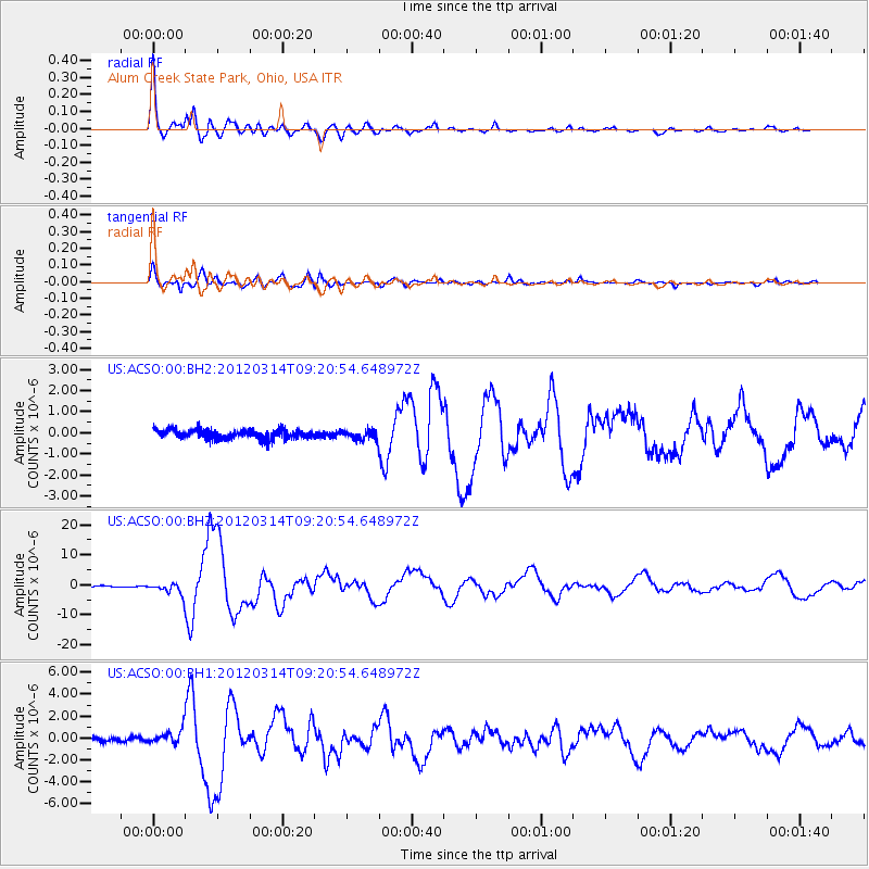
Earthquake location: Off East Coast Of Honshu, Japan
Earthquake latitude/longitude: 40.9/144.9
Earthquake time(UTC): 2012/03/14 (074) 09:08:35 GMT
Earthquake Depth: 12 km
Earthquake Magnitude: 6.7 MB, 6.9 MS, 6.9 MW, 7.0 MW
Earthquake Catalog/Contributor: WHDF/NEIC
Network: US United States National Seismic Network
Station: ACSO Alum Creek State Park, Ohio, USA
Lat/Lon: 40.23 N/82.98 W
Elevation: 288 m
Distance: 88.2 deg
Az: 34.648 deg
Baz: 325.734 deg
Ray Param: 0.04272373
Estimated Moho Depth: 46.25 km
Estimated Crust Vp/Vs: 1.87
Assumed Crust Vp: 6.498 km/s
Estimated Crust Vs: 3.475 km/s
Estimated Crust Poisson's Ratio: 0.30
Radial Match: 98.232666 %
Radial Bump: 400
Transverse Match: 96.287186 %
Transverse Bump: 400
SOD ConfigId: 558545
Insert Time: 2013-09-19 13:41:09.430 +0000
GWidth: 2.5
Max Bumps: 400
Tol: 0.001

Signal To Noise

ChannelStoNSTALTA
US:ACSO:00:BHZ:20120314T09:20:54.648972Z10.8090511.8844772E-61.7434252E-7
US:ACSO:00:BH1:20120314T09:20:54.648972Z3.17008076.156438E-71.9420446E-7
US:ACSO:00:BH2:20120314T09:20:54.648972Z1.04165272.2949769E-72.2032074E-7
Arrivals
Ps6.3 SECOND
PpPs20 SECOND
PsPs/PpSs26 SECOND