
AGMN Agassiz National Wildlife Refuge, Minnesota, USA - Earthquake Result Viewer
| ||||||||||||||||||
| ||||||||||||||||||
| ||||||||||||||||||
|
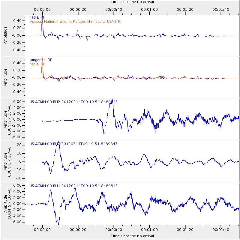
Signal To Noise
| Channel | StoN | STA | LTA |
| US:AGMN:00:BHZ:20120314T09:19:51.848984Z | 41.12344 | 5.3446083E-6 | 1.2996502E-7 |
| US:AGMN:00:BH1:20120314T09:19:51.848984Z | 16.355766 | 1.6824278E-6 | 1.028645E-7 |
| US:AGMN:00:BH2:20120314T09:19:51.848984Z | 5.9922304 | 1.6405688E-6 | 2.7378266E-7 |
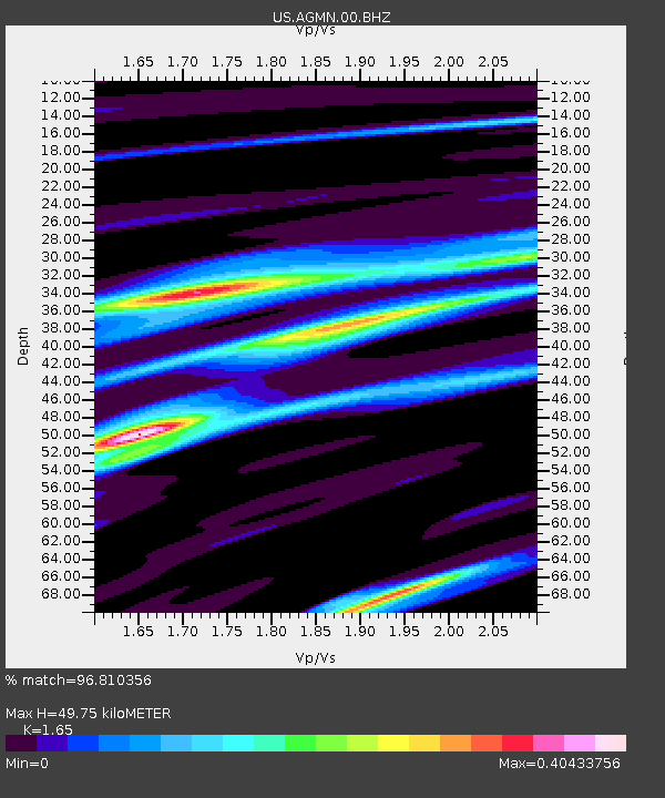
| Arrivals | |
| Ps | 5.2 SECOND |
| PpPs | 20 SECOND |
| PsPs/PpSs | 25 SECOND |

