BOZ Bozeman, Montana, USA - Earthquake Result Viewer
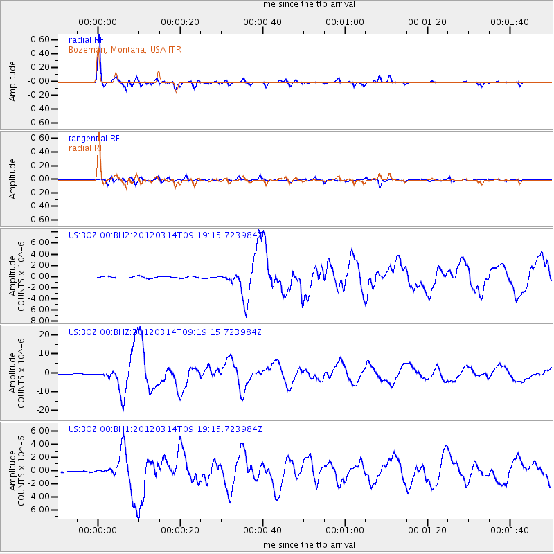
Earthquake location: Off East Coast Of Honshu, Japan
Earthquake latitude/longitude: 40.9/144.9
Earthquake time(UTC): 2012/03/14 (074) 09:08:35 GMT
Earthquake Depth: 12 km
Earthquake Magnitude: 6.7 MB, 6.9 MS, 6.9 MW, 7.0 MW
Earthquake Catalog/Contributor: WHDF/NEIC
Network: US United States National Seismic Network
Station: BOZ Bozeman, Montana, USA
Lat/Lon: 45.65 N/111.63 W
Elevation: 1589 m
Distance: 70.0 deg
Az: 46.541 deg
Baz: 308.322 deg
Ray Param: 0.05523724
Estimated Moho Depth: 33.5 km
Estimated Crust Vp/Vs: 1.82
Assumed Crust Vp: 6.35 km/s
Estimated Crust Vs: 3.499 km/s
Estimated Crust Poisson's Ratio: 0.28
Radial Match: 97.18682 %
Radial Bump: 312
Transverse Match: 88.38358 %
Transverse Bump: 400
SOD ConfigId: 558545
Insert Time: 2013-09-19 13:41:23.322 +0000
GWidth: 2.5
Max Bumps: 400
Tol: 0.001

Signal To Noise

ChannelStoNSTALTA
US:BOZ:00:BHZ:20120314T09:19:15.723984Z6.3665941.0465606E-61.6438311E-7
US:BOZ:00:BH1:20120314T09:19:15.723984Z2.43114733.1745577E-71.3057858E-7
US:BOZ:00:BH2:20120314T09:19:15.723984Z2.66080864.0814206E-71.5339023E-7
Arrivals
Ps4.5 SECOND
PpPs14 SECOND
PsPs/PpSs19 SECOND