CBKS Cedar Bluff, Kansas, USA - Earthquake Result Viewer
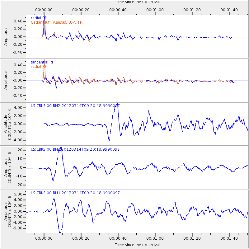
Earthquake location: Off East Coast Of Honshu, Japan
Earthquake latitude/longitude: 40.9/144.9
Earthquake time(UTC): 2012/03/14 (074) 09:08:35 GMT
Earthquake Depth: 12 km
Earthquake Magnitude: 6.7 MB, 6.9 MS, 6.9 MW, 7.0 MW
Earthquake Catalog/Contributor: WHDF/NEIC
Network: US United States National Seismic Network
Station: CBKS Cedar Bluff, Kansas, USA
Lat/Lon: 38.81 N/99.74 W
Elevation: 677 m
Distance: 81.2 deg
Az: 45.618 deg
Baz: 316.085 deg
Ray Param: 0.047780678
Estimated Moho Depth: 48.0 km
Estimated Crust Vp/Vs: 1.70
Assumed Crust Vp: 6.483 km/s
Estimated Crust Vs: 3.819 km/s
Estimated Crust Poisson's Ratio: 0.23
Radial Match: 97.43744 %
Radial Bump: 400
Transverse Match: 86.44556 %
Transverse Bump: 400
SOD ConfigId: 558545
Insert Time: 2013-09-19 13:41:28.009 +0000
GWidth: 2.5
Max Bumps: 400
Tol: 0.001

Signal To Noise

ChannelStoNSTALTA
US:CBKS:00:BHZ:20120314T09:20:18.999009Z39.05744.488089E-61.14910094E-7
US:CBKS:00:BH1:20120314T09:20:18.999009Z7.3334581.0066321E-61.3726569E-7
US:CBKS:00:BH2:20120314T09:20:18.999009Z5.58323679.038459E-71.6188565E-7
Arrivals
Ps5.3 SECOND
PpPs19 SECOND
PsPs/PpSs25 SECOND