
ERPA Erie, Pennsylvania, USA - Earthquake Result Viewer
| ||||||||||||||||||
| ||||||||||||||||||
| ||||||||||||||||||
|
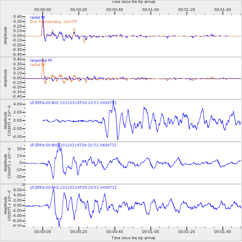
Signal To Noise
| Channel | StoN | STA | LTA |
| US:ERPA:00:BHZ:20120314T09:20:53.049973Z | 9.051317 | 2.1801595E-6 | 2.4086654E-7 |
| US:ERPA:00:BH1:20120314T09:20:53.049973Z | 4.5846205 | 6.366831E-7 | 1.3887369E-7 |
| US:ERPA:00:BH2:20120314T09:20:53.049973Z | 3.0978637 | 4.6983342E-7 | 1.5166368E-7 |
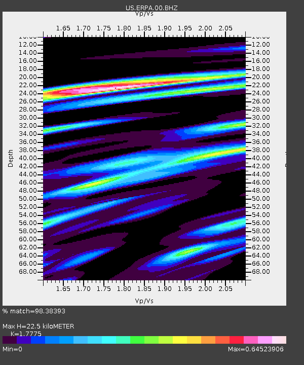
| Arrivals | |
| Ps | 2.8 SECOND |
| PpPs | 9.5 SECOND |
| PsPs/PpSs | 12 SECOND |

