HDIL Hopedale, Illinois, USA - Earthquake Result Viewer
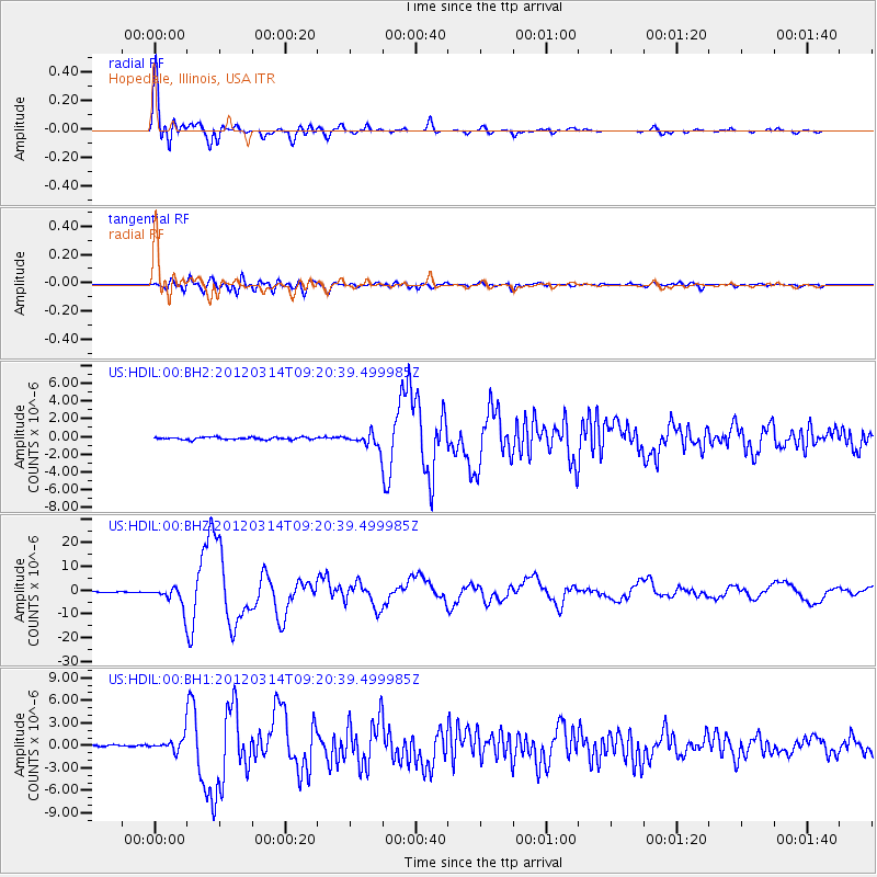
Earthquake location: Off East Coast Of Honshu, Japan
Earthquake latitude/longitude: 40.9/144.9
Earthquake time(UTC): 2012/03/14 (074) 09:08:35 GMT
Earthquake Depth: 12 km
Earthquake Magnitude: 6.7 MB, 6.9 MS, 6.9 MW, 7.0 MW
Earthquake Catalog/Contributor: WHDF/NEIC
Network: US United States National Seismic Network
Station: HDIL Hopedale, Illinois, USA
Lat/Lon: 40.56 N/89.29 W
Elevation: 219 m
Distance: 85.1 deg
Az: 38.352 deg
Baz: 321.871 deg
Ray Param: 0.044974625
Estimated Moho Depth: 18.0 km
Estimated Crust Vp/Vs: 1.60
Assumed Crust Vp: 6.498 km/s
Estimated Crust Vs: 4.061 km/s
Estimated Crust Poisson's Ratio: 0.18
Radial Match: 97.262535 %
Radial Bump: 400
Transverse Match: 82.01849 %
Transverse Bump: 400
SOD ConfigId: 558545
Insert Time: 2013-09-19 13:42:05.108 +0000
GWidth: 2.5
Max Bumps: 400
Tol: 0.001

Signal To Noise

ChannelStoNSTALTA
US:HDIL:00:BHZ:20120314T09:20:39.499985Z31.7197744.327108E-61.3641673E-7
US:HDIL:00:BH1:20120314T09:20:39.499985Z4.96124469.153763E-71.8450537E-7
US:HDIL:00:BH2:20120314T09:20:39.499985Z5.62917.488908E-71.3303917E-7
Arrivals
Ps1.7 SECOND
PpPs7.0 SECOND
PsPs/PpSs8.7 SECOND