MIAR Mount Ida, Arkansas, USA - Earthquake Result Viewer
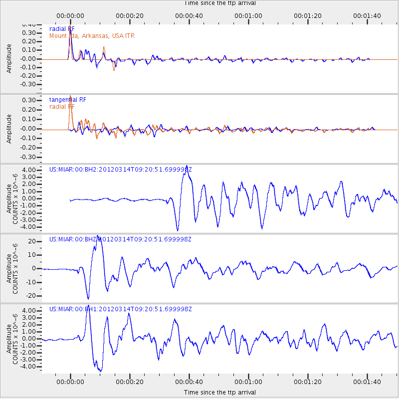
Earthquake location: Off East Coast Of Honshu, Japan
Earthquake latitude/longitude: 40.9/144.9
Earthquake time(UTC): 2012/03/14 (074) 09:08:35 GMT
Earthquake Depth: 12 km
Earthquake Magnitude: 6.7 MB, 6.9 MS, 6.9 MW, 7.0 MW
Earthquake Catalog/Contributor: WHDF/NEIC
Network: US United States National Seismic Network
Station: MIAR Mount Ida, Arkansas, USA
Lat/Lon: 34.55 N/93.58 W
Elevation: 207 m
Distance: 87.6 deg
Az: 44.795 deg
Baz: 319.674 deg
Ray Param: 0.043179918
Estimated Moho Depth: 25.25 km
Estimated Crust Vp/Vs: 2.00
Assumed Crust Vp: 6.498 km/s
Estimated Crust Vs: 3.245 km/s
Estimated Crust Poisson's Ratio: 0.33
Radial Match: 98.11788 %
Radial Bump: 347
Transverse Match: 93.57732 %
Transverse Bump: 400
SOD ConfigId: 558545
Insert Time: 2013-09-19 13:42:36.183 +0000
GWidth: 2.5
Max Bumps: 400
Tol: 0.001

Signal To Noise

ChannelStoNSTALTA
US:MIAR:00:BHZ:20120314T09:20:51.699998Z12.7471531.5612334E-61.2247702E-7
US:MIAR:00:BH1:20120314T09:20:51.699998Z3.6722892.99189E-78.147207E-8
US:MIAR:00:BH2:20120314T09:20:51.699998Z2.01871872.1779769E-71.0788908E-7
Arrivals
Ps4.0 SECOND
PpPs11 SECOND
PsPs/PpSs15 SECOND