MNTX Cornudas Mountains, Texas, USA - Earthquake Result Viewer
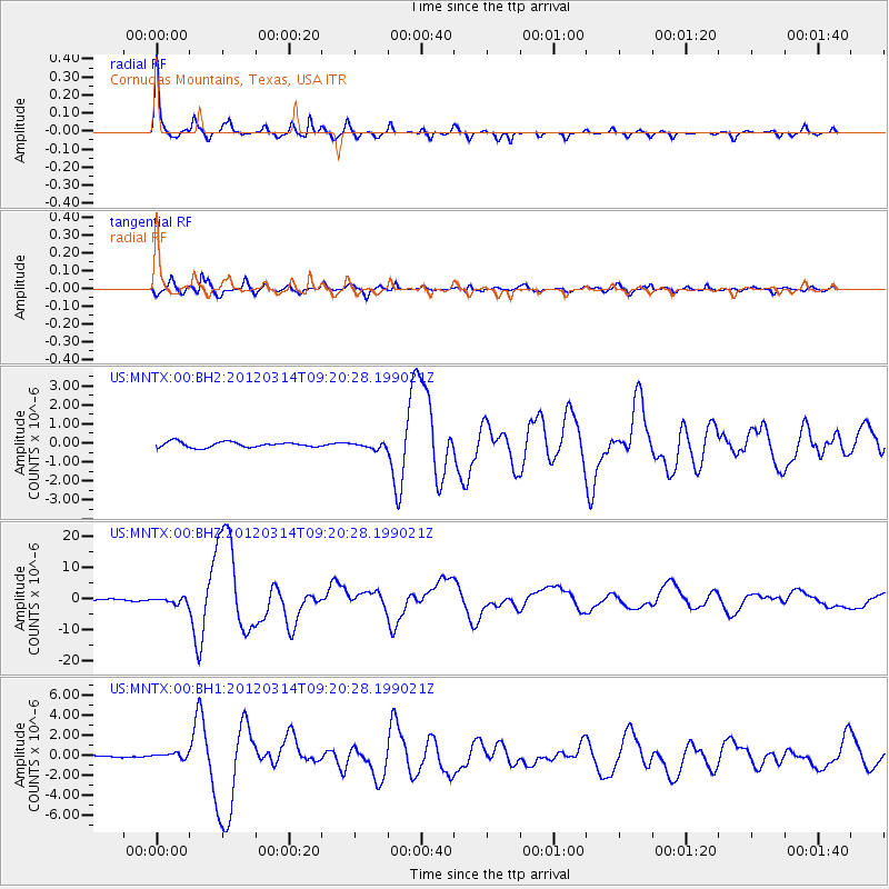
Earthquake location: Off East Coast Of Honshu, Japan
Earthquake latitude/longitude: 40.9/144.9
Earthquake time(UTC): 2012/03/14 (074) 09:08:35 GMT
Earthquake Depth: 12 km
Earthquake Magnitude: 6.7 MB, 6.9 MS, 6.9 MW, 7.0 MW
Earthquake Catalog/Contributor: WHDF/NEIC
Network: US United States National Seismic Network
Station: MNTX Cornudas Mountains, Texas, USA
Lat/Lon: 31.70 N/105.38 W
Elevation: 404 m
Distance: 82.9 deg
Az: 53.981 deg
Baz: 313.994 deg
Ray Param: 0.046553936
Estimated Moho Depth: 35.5 km
Estimated Crust Vp/Vs: 2.02
Assumed Crust Vp: 6.361 km/s
Estimated Crust Vs: 3.157 km/s
Estimated Crust Poisson's Ratio: 0.34
Radial Match: 97.041115 %
Radial Bump: 275
Transverse Match: 92.47622 %
Transverse Bump: 400
SOD ConfigId: 558545
Insert Time: 2013-09-19 13:42:40.043 +0000
GWidth: 2.5
Max Bumps: 400
Tol: 0.001

Signal To Noise

ChannelStoNSTALTA
US:MNTX:00:BHZ:20120314T09:20:28.199021Z3.3281419.1362756E-72.7451588E-7
US:MNTX:00:BH1:20120314T09:20:28.199021Z1.5159862.497638E-71.6475336E-7
US:MNTX:00:BH2:20120314T09:20:28.199021Z1.08563341.534321E-71.4132956E-7
Arrivals
Ps5.8 SECOND
PpPs16 SECOND
PsPs/PpSs22 SECOND