MSO Missoula, Montana, USA - Earthquake Result Viewer
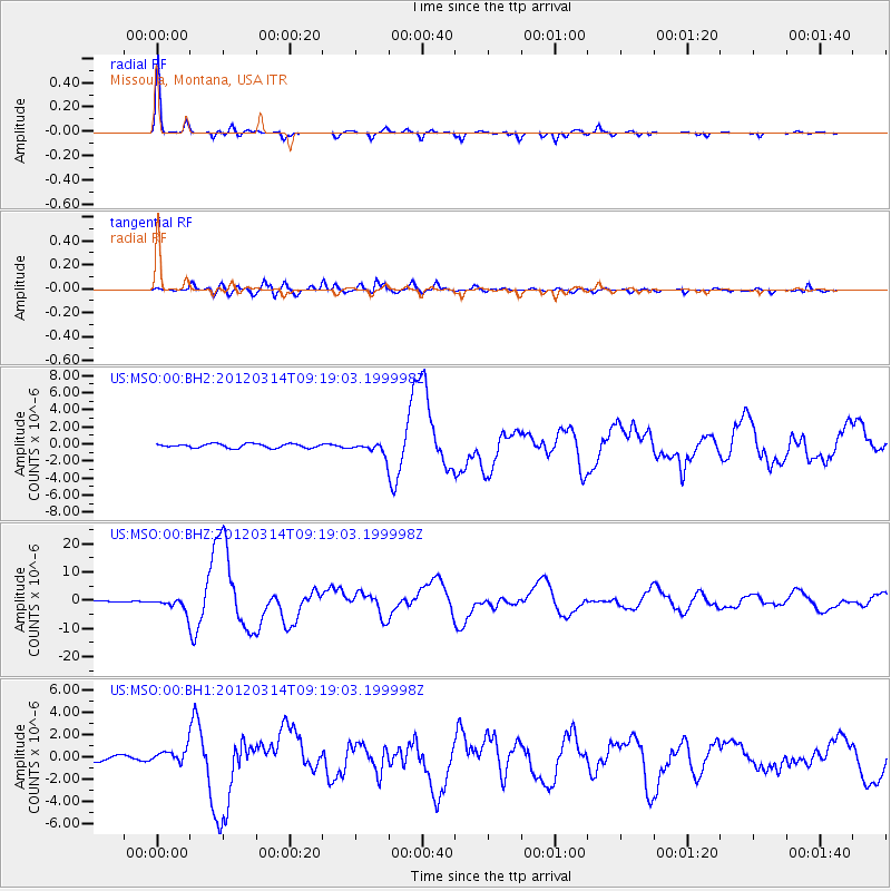
Earthquake location: Off East Coast Of Honshu, Japan
Earthquake latitude/longitude: 40.9/144.9
Earthquake time(UTC): 2012/03/14 (074) 09:08:35 GMT
Earthquake Depth: 12 km
Earthquake Magnitude: 6.7 MB, 6.9 MS, 6.9 MW, 7.0 MW
Earthquake Catalog/Contributor: WHDF/NEIC
Network: US United States National Seismic Network
Station: MSO Missoula, Montana, USA
Lat/Lon: 46.83 N/113.94 W
Elevation: 1264 m
Distance: 68.1 deg
Az: 46.582 deg
Baz: 306.673 deg
Ray Param: 0.056549355
Estimated Moho Depth: 35.5 km
Estimated Crust Vp/Vs: 1.77
Assumed Crust Vp: 6.353 km/s
Estimated Crust Vs: 3.579 km/s
Estimated Crust Poisson's Ratio: 0.27
Radial Match: 96.53026 %
Radial Bump: 238
Transverse Match: 88.441505 %
Transverse Bump: 400
SOD ConfigId: 558545
Insert Time: 2013-09-19 13:42:40.738 +0000
GWidth: 2.5
Max Bumps: 400
Tol: 0.001

Signal To Noise

ChannelStoNSTALTA
US:MSO:00:BHZ:20120314T09:19:03.199998Z13.3615032.3042383E-61.7245353E-7
US:MSO:00:BH1:20120314T09:19:03.199998Z3.39023076.091212E-71.7966954E-7
US:MSO:00:BH2:20120314T09:19:03.199998Z2.93483526.8541874E-72.3354589E-7
Arrivals
Ps4.5 SECOND
PpPs15 SECOND
PsPs/PpSs19 SECOND