NATX Nacogdoches, Texas, USA - Earthquake Result Viewer
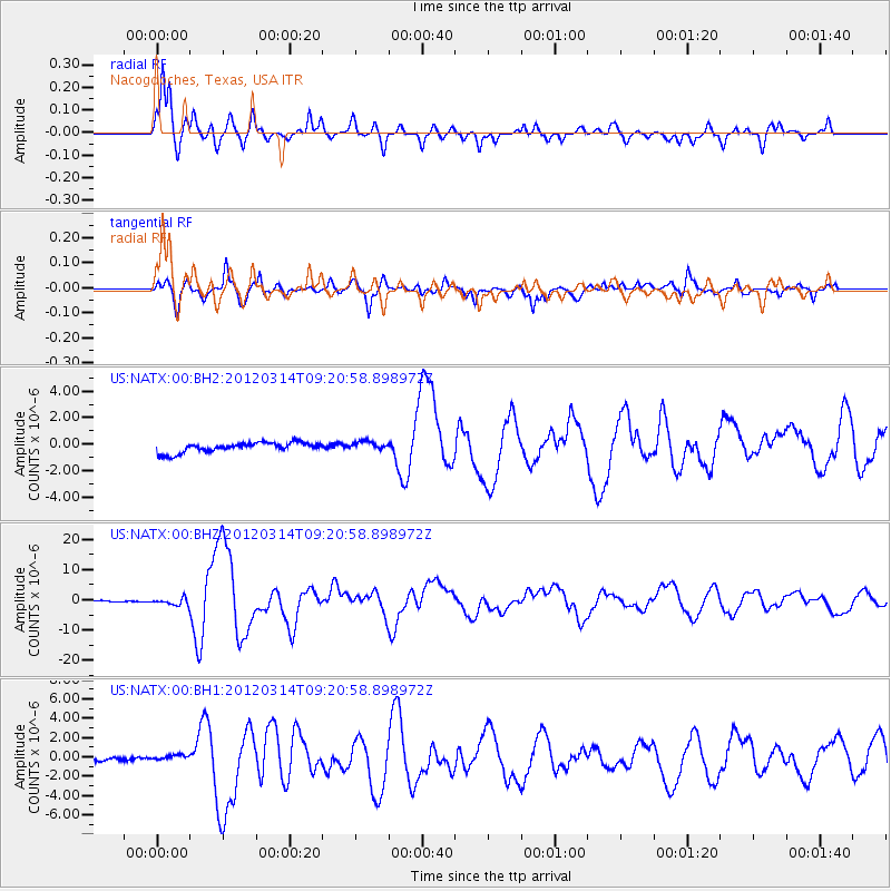
Earthquake location: Off East Coast Of Honshu, Japan
Earthquake latitude/longitude: 40.9/144.9
Earthquake time(UTC): 2012/03/14 (074) 09:08:35 GMT
Earthquake Depth: 12 km
Earthquake Magnitude: 6.7 MB, 6.9 MS, 6.9 MW, 7.0 MW
Earthquake Catalog/Contributor: WHDF/NEIC
Network: US United States National Seismic Network
Station: NATX Nacogdoches, Texas, USA
Lat/Lon: 31.76 N/94.66 W
Elevation: 156 m
Distance: 89.2 deg
Az: 47.294 deg
Baz: 319.153 deg
Ray Param: 0.042054456
Estimated Moho Depth: 10.75 km
Estimated Crust Vp/Vs: 1.98
Assumed Crust Vp: 5.738 km/s
Estimated Crust Vs: 2.902 km/s
Estimated Crust Poisson's Ratio: 0.33
Radial Match: 93.40616 %
Radial Bump: 343
Transverse Match: 85.21446 %
Transverse Bump: 400
SOD ConfigId: 558545
Insert Time: 2013-09-19 13:42:46.154 +0000
GWidth: 2.5
Max Bumps: 400
Tol: 0.001

Signal To Noise

ChannelStoNSTALTA
US:NATX:00:BHZ:20120314T09:20:58.898972Z7.11047941.1482637E-61.6148893E-7
US:NATX:00:BH1:20120314T09:20:58.898972Z1.76203173.0069506E-71.7065247E-7
US:NATX:00:BH2:20120314T09:20:58.898972Z0.90830333.36843E-73.7084857E-7
Arrivals
Ps1.9 SECOND
PpPs5.5 SECOND
PsPs/PpSs7.4 SECOND