NEW Newport, Washington, USA - Earthquake Result Viewer
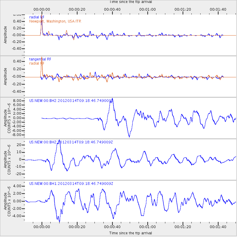
Earthquake location: Off East Coast Of Honshu, Japan
Earthquake latitude/longitude: 40.9/144.9
Earthquake time(UTC): 2012/03/14 (074) 09:08:35 GMT
Earthquake Depth: 12 km
Earthquake Magnitude: 6.7 MB, 6.9 MS, 6.9 MW, 7.0 MW
Earthquake Catalog/Contributor: WHDF/NEIC
Network: US United States National Seismic Network
Station: NEW Newport, Washington, USA
Lat/Lon: 48.26 N/117.12 W
Elevation: 760 m
Distance: 65.5 deg
Az: 46.673 deg
Baz: 304.37 deg
Ray Param: 0.05824676
Estimated Moho Depth: 48.25 km
Estimated Crust Vp/Vs: 1.76
Assumed Crust Vp: 6.571 km/s
Estimated Crust Vs: 3.733 km/s
Estimated Crust Poisson's Ratio: 0.26
Radial Match: 95.14142 %
Radial Bump: 398
Transverse Match: 87.4085 %
Transverse Bump: 400
SOD ConfigId: 558545
Insert Time: 2013-09-19 13:42:51.263 +0000
GWidth: 2.5
Max Bumps: 400
Tol: 0.001

Signal To Noise

ChannelStoNSTALTA
US:NEW:00:BHZ:20120314T09:18:46.749009Z15.6675672.4182136E-61.5434519E-7
US:NEW:00:BH1:20120314T09:18:46.749009Z2.51102146.450479E-72.5688666E-7
US:NEW:00:BH2:20120314T09:18:46.749009Z8.1368139.265912E-71.13876425E-7
Arrivals
Ps5.8 SECOND
PpPs19 SECOND
PsPs/PpSs25 SECOND