
SCIA State Center, Iowa, USA - Earthquake Result Viewer
| ||||||||||||||||||
| ||||||||||||||||||
| ||||||||||||||||||
|
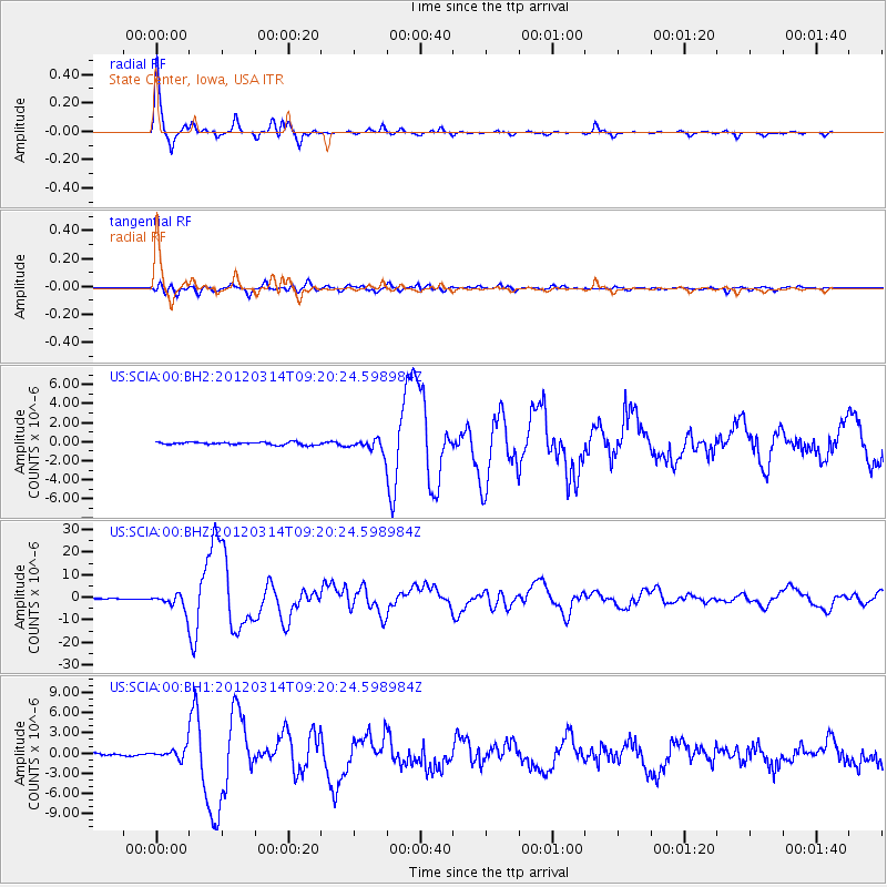
Signal To Noise
| Channel | StoN | STA | LTA |
| US:SCIA:00:BHZ:20120314T09:20:24.598984Z | 21.396893 | 3.52843E-6 | 1.6490385E-7 |
| US:SCIA:00:BH1:20120314T09:20:24.598984Z | 4.7670984 | 7.79304E-7 | 1.6347555E-7 |
| US:SCIA:00:BH2:20120314T09:20:24.598984Z | 4.6562357 | 6.32608E-7 | 1.3586255E-7 |
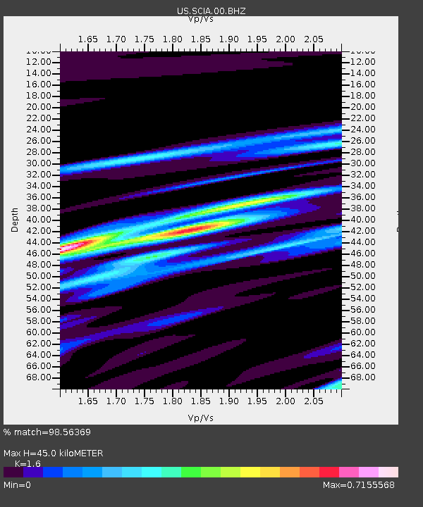
| Arrivals | |
| Ps | 4.3 SECOND |
| PpPs | 17 SECOND |
| PsPs/PpSs | 22 SECOND |

