WUAZ Wupatki, Arizona, USA - Earthquake Result Viewer
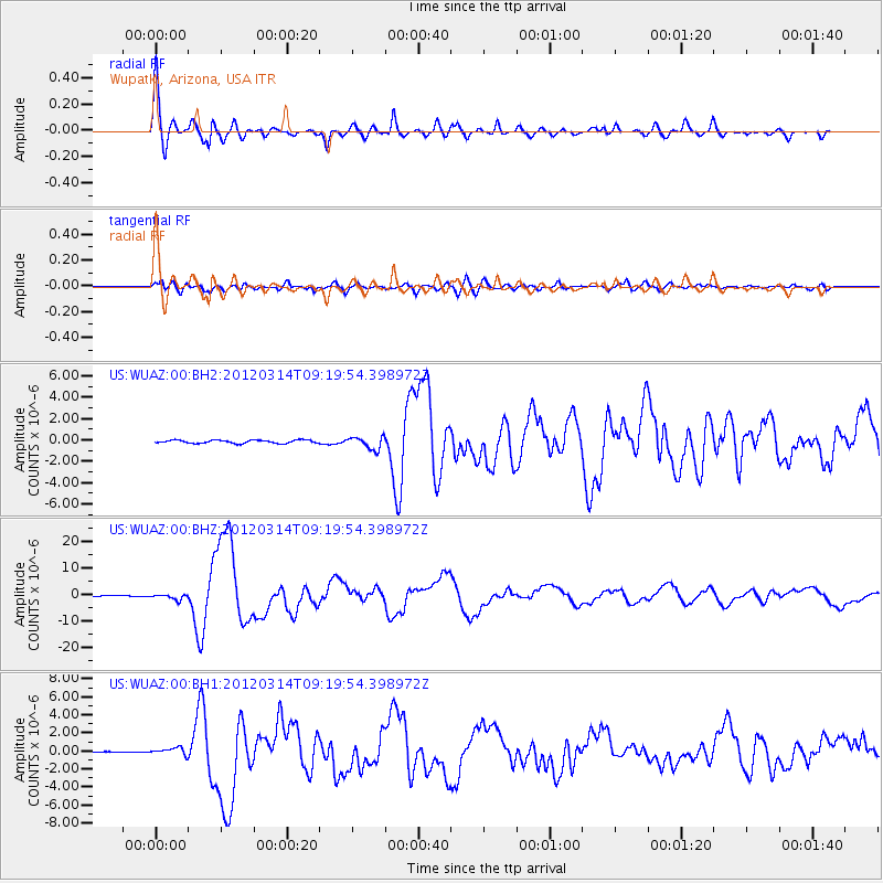
Earthquake location: Off East Coast Of Honshu, Japan
Earthquake latitude/longitude: 40.9/144.9
Earthquake time(UTC): 2012/03/14 (074) 09:08:35 GMT
Earthquake Depth: 12 km
Earthquake Magnitude: 6.7 MB, 6.9 MS, 6.9 MW, 7.0 MW
Earthquake Catalog/Contributor: WHDF/NEIC
Network: US United States National Seismic Network
Station: WUAZ Wupatki, Arizona, USA
Lat/Lon: 35.52 N/111.37 W
Elevation: 1592 m
Distance: 76.7 deg
Az: 54.551 deg
Baz: 310.791 deg
Ray Param: 0.050845083
Estimated Moho Depth: 33.0 km
Estimated Crust Vp/Vs: 2.03
Assumed Crust Vp: 6.207 km/s
Estimated Crust Vs: 3.061 km/s
Estimated Crust Poisson's Ratio: 0.34
Radial Match: 96.843 %
Radial Bump: 380
Transverse Match: 84.91845 %
Transverse Bump: 400
SOD ConfigId: 558545
Insert Time: 2013-09-19 13:43:19.785 +0000
GWidth: 2.5
Max Bumps: 400
Tol: 0.001

Signal To Noise

ChannelStoNSTALTA
US:WUAZ:00:BHZ:20120314T09:19:54.398972Z5.89662651.0450491E-61.7722829E-7
US:WUAZ:00:BH1:20120314T09:19:54.398972Z1.44174683.8418034E-72.6646865E-7
US:WUAZ:00:BH2:20120314T09:19:54.398972Z3.85918935.8678637E-71.5204913E-7
Arrivals
Ps5.6 SECOND
PpPs16 SECOND
PsPs/PpSs21 SECOND