You are here: Home > Network List > US - United States National Seismic Network Stations List
> Station AMTX Amarillo, Texas, USA > Earthquake Result Viewer
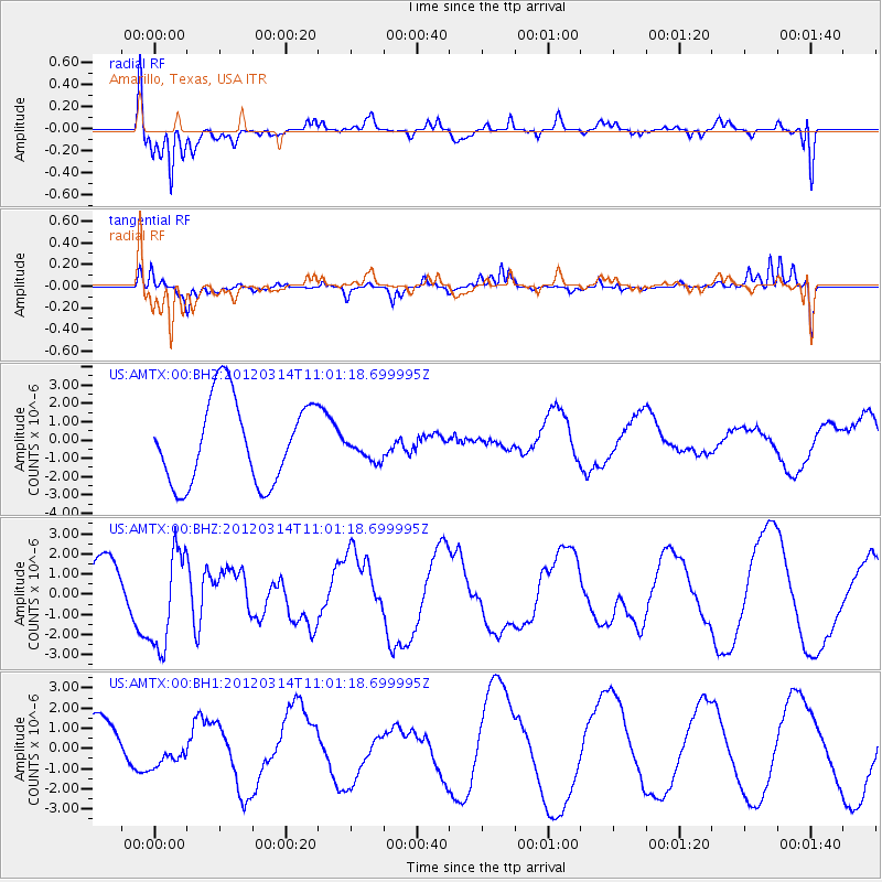
AMTX Amarillo, Texas, USA - Earthquake Result Viewer
*The percent match for this event was below the threshold and hence no stack was calculated.
| Earthquake location: |
Off East Coast Of Honshu, Japan |
| Earthquake latitude/longitude: |
40.8/144.8 |
| Earthquake time(UTC): |
2012/03/14 (074) 10:49:24 GMT |
| Earthquake Depth: |
10 km |
| Earthquake Magnitude: |
5.8 MB, 6.1 MW |
| Earthquake Catalog/Contributor: |
WHDF/NEIC |
|
| Network: |
US United States National Seismic Network |
| Station: |
AMTX Amarillo, Texas, USA |
| Lat/Lon: |
34.53 N/101.41 W |
| Elevation: |
1010 m |
|
| Distance: |
83.5 deg |
| Az: |
49.478 deg |
| Baz: |
315.639 deg |
| Ray Param: |
$rayparam |
*The percent match for this event was below the threshold and hence was not used in the summary stack. |
|
| Radial Match: |
64.93169 % |
| Radial Bump: |
400 |
| Transverse Match: |
71.25983 % |
| Transverse Bump: |
355 |
| SOD ConfigId: |
558545 |
| Insert Time: |
2013-09-19 13:45:53.187 +0000 |
| GWidth: |
2.5 |
| Max Bumps: |
400 |
| Tol: |
0.001 |
|
Signal To Noise
| Channel | StoN | STA | LTA |
| US:AMTX:00:BHZ:20120314T11:01:18.699995Z | 2.013841 | 2.4406504E-6 | 1.2119381E-6 |
| US:AMTX:00:BH1:20120314T11:01:18.699995Z | 0.6988015 | 8.268711E-7 | 1.1832703E-6 |
| US:AMTX:00:BH2:20120314T11:01:18.699995Z | 0.4022061 | 9.3152585E-7 | 2.3160412E-6 |
| Arrivals |
| Ps | |
| PpPs | |
| PsPs/PpSs | |


