You are here: Home > Network List > II - Global Seismograph Network (GSN - IRIS/IDA) Stations List
> Station WRAB Tennant Creek, NT, Australia > Earthquake Result Viewer
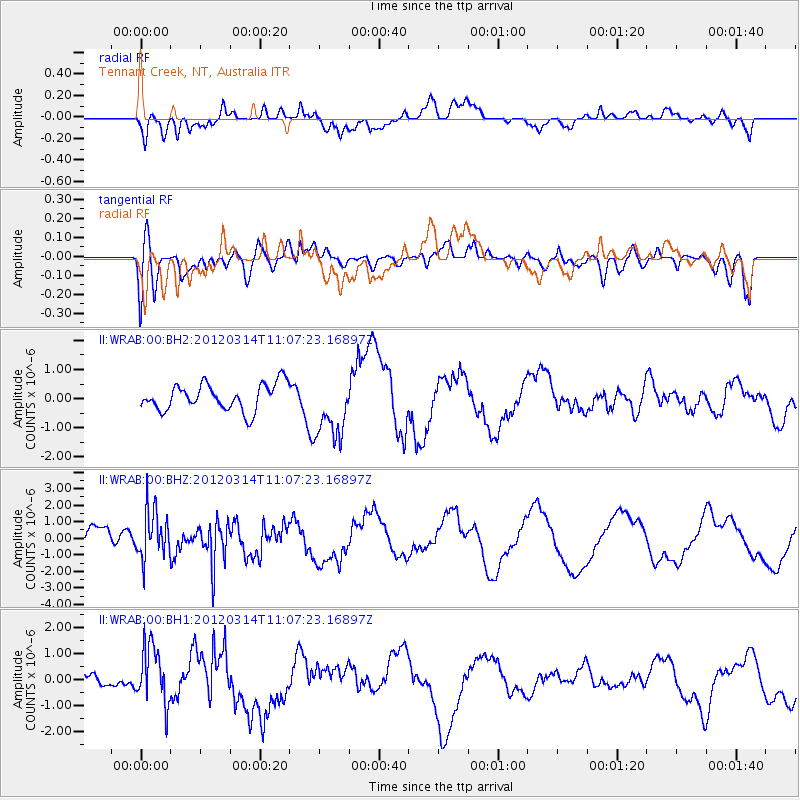
WRAB Tennant Creek, NT, Australia - Earthquake Result Viewer
*The percent match for this event was below the threshold and hence no stack was calculated.
| Earthquake location: |
Off East Coast Of Honshu, Japan |
| Earthquake latitude/longitude: |
40.8/144.8 |
| Earthquake time(UTC): |
2012/03/14 (074) 10:57:40 GMT |
| Earthquake Depth: |
12 km |
| Earthquake Magnitude: |
5.6 MB |
| Earthquake Catalog/Contributor: |
WHDF/NEIC |
|
| Network: |
II Global Seismograph Network (GSN - IRIS/IDA) |
| Station: |
WRAB Tennant Creek, NT, Australia |
| Lat/Lon: |
19.93 S/134.36 E |
| Elevation: |
366 m |
|
| Distance: |
61.2 deg |
| Az: |
191.23 deg |
| Baz: |
9.047 deg |
| Ray Param: |
$rayparam |
*The percent match for this event was below the threshold and hence was not used in the summary stack. |
|
| Radial Match: |
60.86064 % |
| Radial Bump: |
400 |
| Transverse Match: |
41.26453 % |
| Transverse Bump: |
400 |
| SOD ConfigId: |
558545 |
| Insert Time: |
2013-09-19 13:48:23.650 +0000 |
| GWidth: |
2.5 |
| Max Bumps: |
400 |
| Tol: |
0.001 |
|
Signal To Noise
| Channel | StoN | STA | LTA |
| II:WRAB:00:BHZ:20120314T11:07:23.16897Z | 2.2755005 | 1.4733115E-6 | 6.47467E-7 |
| II:WRAB:00:BH1:20120314T11:07:23.16897Z | 1.8869952 | 1.130838E-6 | 5.9927976E-7 |
| II:WRAB:00:BH2:20120314T11:07:23.16897Z | 2.4308114 | 1.1001515E-6 | 4.5258614E-7 |
| Arrivals |
| Ps | |
| PpPs | |
| PsPs/PpSs | |


