You are here: Home > Network List > US - United States National Seismic Network Stations List
> Station EGMT Eagleton, Montana, USA > Earthquake Result Viewer
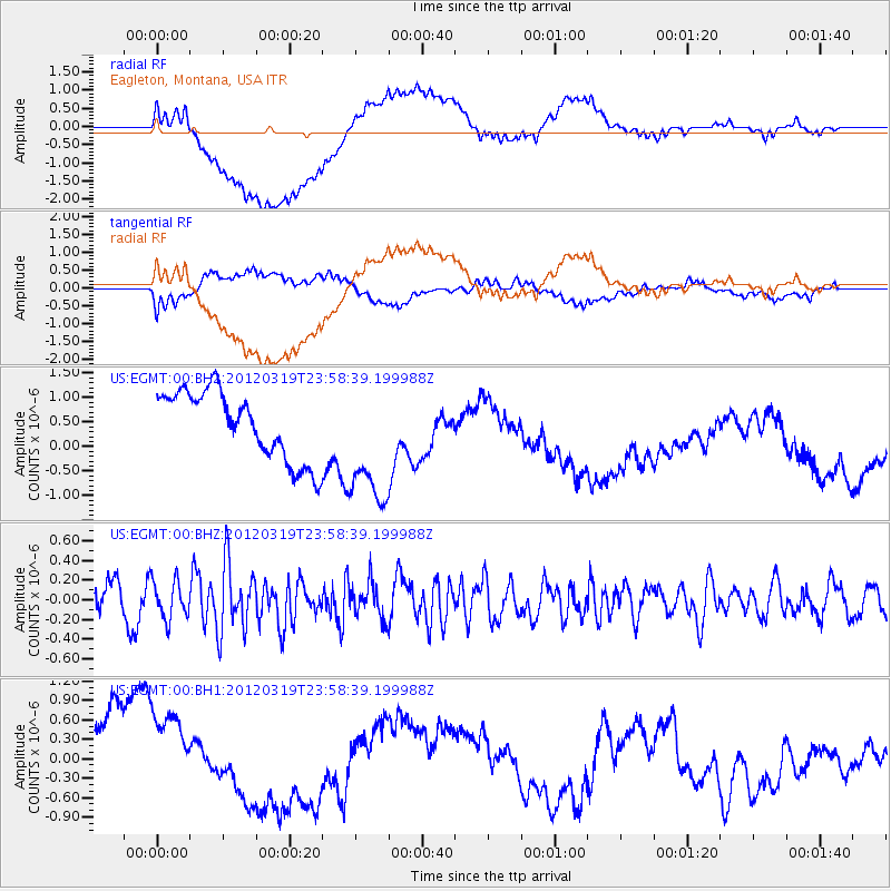
EGMT Eagleton, Montana, USA - Earthquake Result Viewer
*The percent match for this event was below the threshold and hence no stack was calculated.
| Earthquake location: |
Samoa Islands Region |
| Earthquake latitude/longitude: |
-14.6/-175.7 |
| Earthquake time(UTC): |
2012/03/19 (079) 23:46:35 GMT |
| Earthquake Depth: |
28 km |
| Earthquake Magnitude: |
5.9 MW, 5.5 MB, 5.5 MS, 5.7 MW |
| Earthquake Catalog/Contributor: |
NEIC PDE/NEIC PDE-M |
|
| Network: |
US United States National Seismic Network |
| Station: |
EGMT Eagleton, Montana, USA |
| Lat/Lon: |
48.02 N/109.75 W |
| Elevation: |
1055 m |
|
| Distance: |
85.5 deg |
| Az: |
37.947 deg |
| Baz: |
242.467 deg |
| Ray Param: |
$rayparam |
*The percent match for this event was below the threshold and hence was not used in the summary stack. |
|
| Radial Match: |
53.67348 % |
| Radial Bump: |
400 |
| Transverse Match: |
42.823032 % |
| Transverse Bump: |
400 |
| SOD ConfigId: |
558545 |
| Insert Time: |
2013-09-19 14:13:11.227 +0000 |
| GWidth: |
2.5 |
| Max Bumps: |
400 |
| Tol: |
0.001 |
|
Signal To Noise
| Channel | StoN | STA | LTA |
| US:EGMT:00:BHZ:20120319T23:58:39.199988Z | 1.6609975 | 1.9196085E-7 | 1.1556962E-7 |
| US:EGMT:00:BH1:20120319T23:58:39.199988Z | 1.2838165 | 9.096803E-7 | 7.0857504E-7 |
| US:EGMT:00:BH2:20120319T23:58:39.199988Z | 1.8546427 | 1.2921048E-6 | 6.9668664E-7 |
| Arrivals |
| Ps | |
| PpPs | |
| PsPs/PpSs | |


