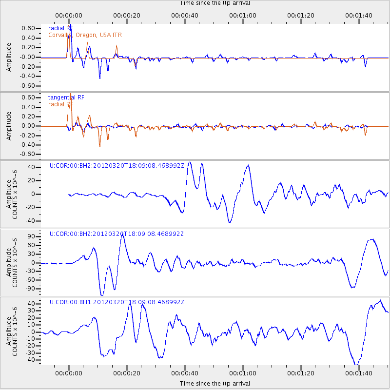
COR Corvallis, Oregon, USA - Earthquake Result Viewer
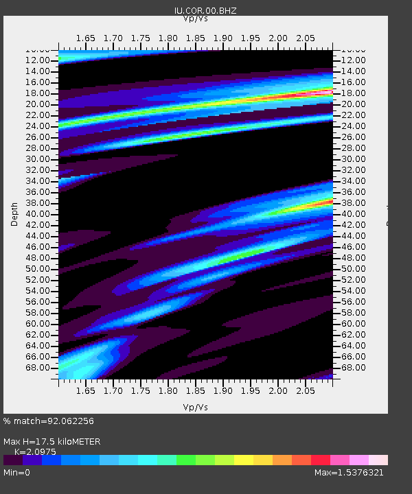
Earthquake location: Near Coast Of Guerrero, Mexico
Earthquake latitude/longitude: 16.5/-98.2
Earthquake time(UTC): 2012/03/20 (080) 18:02:47 GMT
Earthquake Depth: 20 km
Earthquake Magnitude: 6.6 MB, 7.6 MS, 7.4 MW, 7.4 MW
Earthquake Catalog/Contributor: WHDF/NEIC
Network: IU Global Seismograph Network (GSN - IRIS/USGS)
Station: COR Corvallis, Oregon, USA
Lat/Lon: 44.59 N/123.30 W
Elevation: 110 m
Distance: 35.1 deg
Az: 328.208 deg
Baz: 134.981 deg
Ray Param: 0.07738414
Estimated Moho Depth: 17.5 km
Estimated Crust Vp/Vs: 2.10
Assumed Crust Vp: 6.566 km/s
Estimated Crust Vs: 3.13 km/s
Estimated Crust Poisson's Ratio: 0.35
Radial Match: 92.062256 %
Radial Bump: 236
Transverse Match: 74.318 %
Transverse Bump: 400
SOD ConfigId: 558545
Insert Time: 2013-09-19 14:18:21.661 +0000
GWidth: 2.5
Max Bumps: 400
Tol: 0.001

Signal To Noise

ChannelStoNSTALTA
IU:COR:00:BHZ:20120320T18:09:08.468992Z8.3029821.105322E-51.331235E-6
IU:COR:00:BH1:20120320T18:09:08.468992Z5.0241834.5677584E-69.091545E-7
IU:COR:00:BH2:20120320T18:09:08.468992Z2.65945845.0067706E-61.8826279E-6
Arrivals
Ps3.1 SECOND
PpPs7.7 SECOND
PsPs/PpSs11 SECOND