You are here: Home > Network List > US - United States National Seismic Network Stations List
> Station DGMT Dagmar, Montana, USA > Earthquake Result Viewer
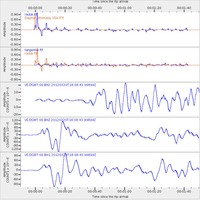
DGMT Dagmar, Montana, USA - Earthquake Result Viewer
*The percent match for this event was below the threshold and hence no stack was calculated.
| Earthquake location: |
Near Coast Of Guerrero, Mexico |
| Earthquake latitude/longitude: |
16.5/-98.2 |
| Earthquake time(UTC): |
2012/03/20 (080) 18:02:47 GMT |
| Earthquake Depth: |
20 km |
| Earthquake Magnitude: |
6.6 MB, 7.6 MS, 7.4 MW, 7.4 MW |
| Earthquake Catalog/Contributor: |
WHDF/NEIC |
|
| Network: |
US United States National Seismic Network |
| Station: |
DGMT Dagmar, Montana, USA |
| Lat/Lon: |
48.47 N/104.20 W |
| Elevation: |
0.0 m |
|
| Distance: |
32.3 deg |
| Az: |
352.557 deg |
| Baz: |
169.237 deg |
| Ray Param: |
$rayparam |
*The percent match for this event was below the threshold and hence was not used in the summary stack. |
|
| Radial Match: |
97.071465 % |
| Radial Bump: |
222 |
| Transverse Match: |
84.68695 % |
| Transverse Bump: |
337 |
| SOD ConfigId: |
558545 |
| Insert Time: |
2013-09-19 14:19:15.443 +0000 |
| GWidth: |
2.5 |
| Max Bumps: |
400 |
| Tol: |
0.001 |
|
Signal To Noise
| Channel | StoN | STA | LTA |
| US:DGMT:00:BHZ:20120320T18:08:43.99899Z | 60.797443 | 1.837389E-5 | 3.0221483E-7 |
| US:DGMT:00:BH1:20120320T18:08:43.99899Z | 15.457252 | 8.797852E-6 | 5.6917315E-7 |
| US:DGMT:00:BH2:20120320T18:08:43.99899Z | 1.9295628 | 1.832993E-6 | 9.4995255E-7 |
| Arrivals |
| Ps | |
| PpPs | |
| PsPs/PpSs | |


