
EGMT Eagleton, Montana, USA - Earthquake Result Viewer
| ||||||||||||||||||
| ||||||||||||||||||
| ||||||||||||||||||
|
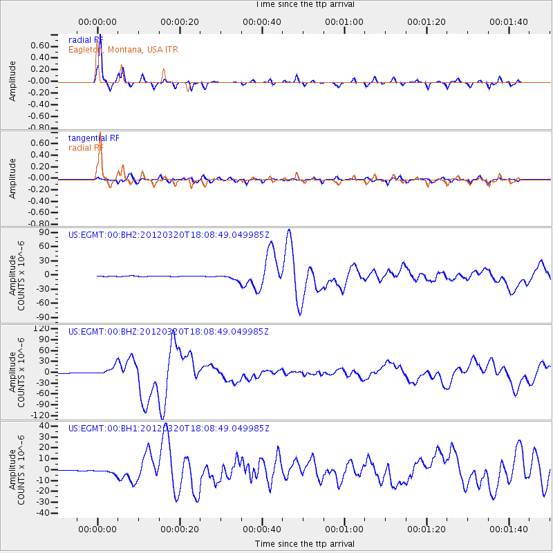
Signal To Noise
| Channel | StoN | STA | LTA |
| US:EGMT:00:BHZ:20120320T18:08:49.049985Z | 39.090427 | 1.4274383E-5 | 3.6516315E-7 |
| US:EGMT:00:BH1:20120320T18:08:49.049985Z | 6.641539 | 2.137681E-6 | 3.218653E-7 |
| US:EGMT:00:BH2:20120320T18:08:49.049985Z | 10.544796 | 6.3717234E-6 | 6.042529E-7 |
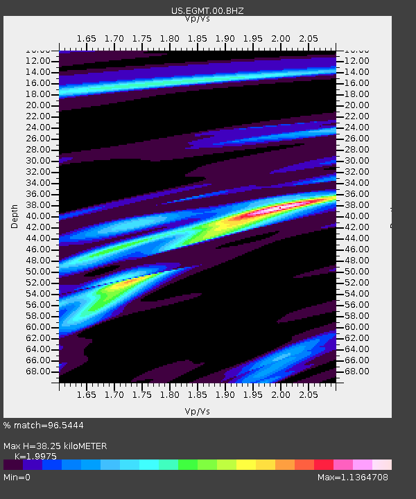
| Arrivals | |
| Ps | 6.4 SECOND |
| PpPs | 17 SECOND |
| PsPs/PpSs | 23 SECOND |

