
LONY Lake Ozonia, New York, USA - Earthquake Result Viewer
| ||||||||||||||||||
| ||||||||||||||||||
| ||||||||||||||||||
|
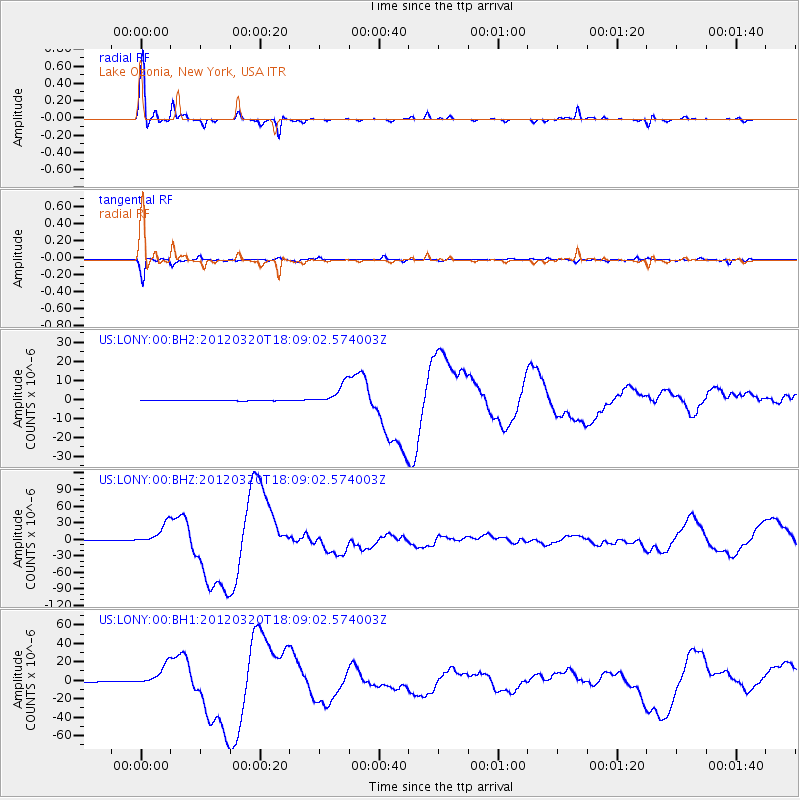
Signal To Noise
| Channel | StoN | STA | LTA |
| US:LONY:00:BHZ:20120320T18:09:02.574003Z | 72.32554 | 1.9083105E-5 | 2.6385018E-7 |
| US:LONY:00:BH1:20120320T18:09:02.574003Z | 58.07731 | 1.14147715E-5 | 1.9654443E-7 |
| US:LONY:00:BH2:20120320T18:09:02.574003Z | 43.539738 | 5.7033626E-6 | 1.3099212E-7 |
| Arrivals | |
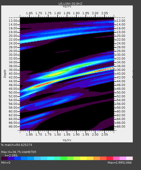
| Ps | 6.7 SECOND |
| PpPs | 17 SECOND |
| PsPs/PpSs | 23 SECOND |

