PKME Peaks-Kenny State Park, Maine, USA - Earthquake Result Viewer
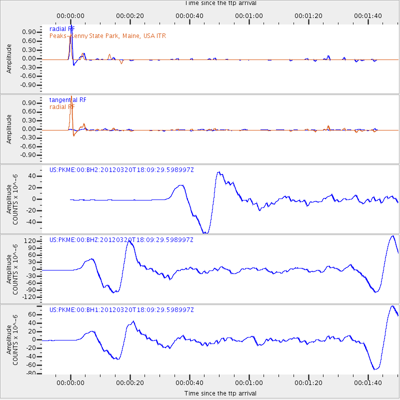
Earthquake location: Near Coast Of Guerrero, Mexico
Earthquake latitude/longitude: 16.5/-98.2
Earthquake time(UTC): 2012/03/20 (080) 18:02:47 GMT
Earthquake Depth: 20 km
Earthquake Magnitude: 6.6 MB, 7.6 MS, 7.4 MW, 7.4 MW
Earthquake Catalog/Contributor: WHDF/NEIC
Network: US United States National Seismic Network
Station: PKME Peaks-Kenny State Park, Maine, USA
Lat/Lon: 45.26 N/69.29 W
Elevation: 108 m
Distance: 37.6 deg
Az: 34.094 deg
Baz: 229.595 deg
Ray Param: 0.07604328
Estimated Moho Depth: 43.75 km
Estimated Crust Vp/Vs: 1.63
Assumed Crust Vp: 6.419 km/s
Estimated Crust Vs: 3.938 km/s
Estimated Crust Poisson's Ratio: 0.20
Radial Match: 95.73557 %
Radial Bump: 185
Transverse Match: 62.65736 %
Transverse Bump: 400
SOD ConfigId: 558545
Insert Time: 2013-09-19 14:19:46.488 +0000
GWidth: 2.5
Max Bumps: 400
Tol: 0.001

Signal To Noise

ChannelStoNSTALTA
US:PKME:00:BHZ:20120320T18:09:29.598997Z48.5329321.2569295E-52.5898487E-7
US:PKME:00:BH1:20120320T18:09:29.598997Z8.8636095.782282E-66.52362E-7
US:PKME:00:BH2:20120320T18:09:29.598997Z27.8069115.8524047E-62.1046583E-7
Arrivals
Ps4.7 SECOND
PpPs17 SECOND
PsPs/PpSs21 SECOND