You are here: Home > Network List > US - United States National Seismic Network Stations List
> Station LKWY Lake (Yellowstone--Lake), Wyoming, USA > Earthquake Result Viewer
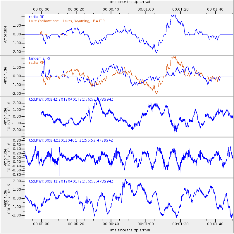
LKWY Lake (Yellowstone--Lake), Wyoming, USA - Earthquake Result Viewer
*The percent match for this event was below the threshold and hence no stack was calculated.
| Earthquake location: |
New Ireland Region, P.N.G. |
| Earthquake latitude/longitude: |
-4.5/153.4 |
| Earthquake time(UTC): |
2012/04/01 (092) 21:44:04 GMT |
| Earthquake Depth: |
118 km |
| Earthquake Magnitude: |
5.7 MW, 5.4 MB, 5.8 MW |
| Earthquake Catalog/Contributor: |
WHDF/NEIC |
|
| Network: |
US United States National Seismic Network |
| Station: |
LKWY Lake (Yellowstone--Lake), Wyoming, USA |
| Lat/Lon: |
44.57 N/110.40 W |
| Elevation: |
2424 m |
|
| Distance: |
97.5 deg |
| Az: |
45.797 deg |
| Baz: |
271.102 deg |
| Ray Param: |
$rayparam |
*The percent match for this event was below the threshold and hence was not used in the summary stack. |
|
| Radial Match: |
27.258326 % |
| Radial Bump: |
400 |
| Transverse Match: |
45.634212 % |
| Transverse Bump: |
400 |
| SOD ConfigId: |
558545 |
| Insert Time: |
2013-09-19 14:53:53.764 +0000 |
| GWidth: |
2.5 |
| Max Bumps: |
400 |
| Tol: |
0.001 |
|
Signal To Noise
| Channel | StoN | STA | LTA |
| US:LKWY:00:BHZ:20120401T21:56:53.473994Z | 1.3134891 | 1.8366975E-7 | 1.3983349E-7 |
| US:LKWY:00:BH1:20120401T21:56:53.473994Z | 1.5104649 | 6.907708E-7 | 4.5732327E-7 |
| US:LKWY:00:BH2:20120401T21:56:53.473994Z | 4.3102837 | 2.3572766E-6 | 5.4689593E-7 |
| Arrivals |
| Ps | |
| PpPs | |
| PsPs/PpSs | |


