PKME Peaks-Kenny State Park, Maine, USA - Earthquake Result Viewer
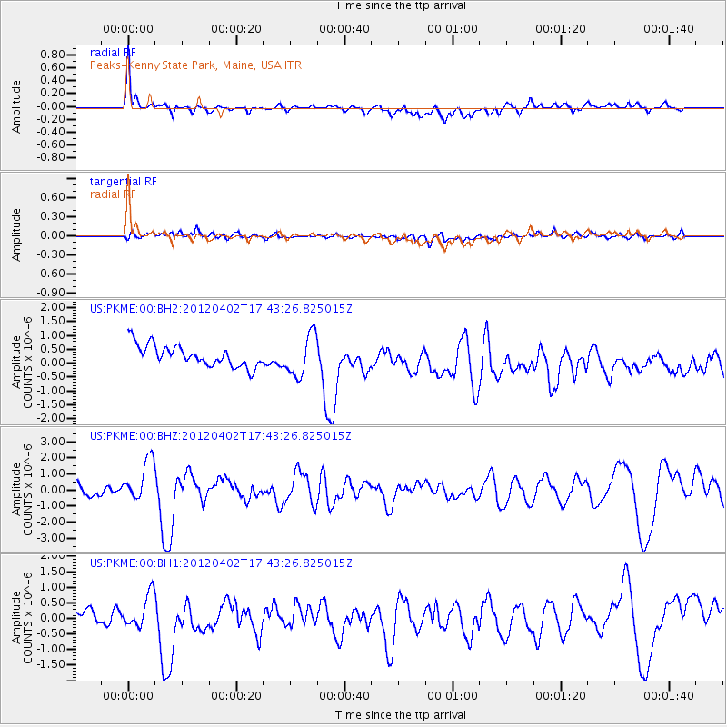
Earthquake location: Near Coast Of Guerrero, Mexico
Earthquake latitude/longitude: 16.4/-98.3
Earthquake time(UTC): 2012/04/02 (093) 17:36:42 GMT
Earthquake Depth: 9.0 km
Earthquake Magnitude: 5.8 MB, 5.9 MS, 6.0 MW, 6.0 MW
Earthquake Catalog/Contributor: WHDF/NEIC
Network: US United States National Seismic Network
Station: PKME Peaks-Kenny State Park, Maine, USA
Lat/Lon: 45.26 N/69.29 W
Elevation: 108 m
Distance: 37.7 deg
Az: 34.086 deg
Baz: 229.616 deg
Ray Param: 0.075998195
Estimated Moho Depth: 17.75 km
Estimated Crust Vp/Vs: 1.60
Assumed Crust Vp: 6.419 km/s
Estimated Crust Vs: 4.006 km/s
Estimated Crust Poisson's Ratio: 0.18
Radial Match: 86.97106 %
Radial Bump: 400
Transverse Match: 53.385113 %
Transverse Bump: 400
SOD ConfigId: 558545
Insert Time: 2013-09-19 14:56:50.216 +0000
GWidth: 2.5
Max Bumps: 400
Tol: 0.001

Signal To Noise

ChannelStoNSTALTA
US:PKME:00:BHZ:20120402T17:43:26.825015Z4.07131531.3345333E-63.2778922E-7
US:PKME:00:BH1:20120402T17:43:26.825015Z2.32192785.2241654E-72.2499258E-7
US:PKME:00:BH2:20120402T17:43:26.825015Z1.99068017.5979784E-73.8167752E-7
Arrivals
Ps1.8 SECOND
PpPs6.6 SECOND
PsPs/PpSs8.4 SECOND