You are here: Home > Network List > II - Global Seismograph Network (GSN - IRIS/IDA) Stations List
> Station KAPI Kappang, Sulawesi, Indonesia > Earthquake Result Viewer
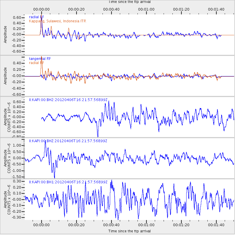
KAPI Kappang, Sulawesi, Indonesia - Earthquake Result Viewer
*The percent match for this event was below the threshold and hence no stack was calculated.
| Earthquake location: |
New Ireland Region, P.N.G. |
| Earthquake latitude/longitude: |
-4.6/153.5 |
| Earthquake time(UTC): |
2012/04/06 (097) 16:15:58 GMT |
| Earthquake Depth: |
108 km |
| Earthquake Magnitude: |
5.5 MB, 6.1 MW, 6.1 MW |
| Earthquake Catalog/Contributor: |
WHDF/NEIC |
|
| Network: |
II Global Seismograph Network (GSN - IRIS/IDA) |
| Station: |
KAPI Kappang, Sulawesi, Indonesia |
| Lat/Lon: |
5.01 S/119.75 E |
| Elevation: |
300 m |
|
| Distance: |
33.6 deg |
| Az: |
267.801 deg |
| Baz: |
90.675 deg |
| Ray Param: |
$rayparam |
*The percent match for this event was below the threshold and hence was not used in the summary stack. |
|
| Radial Match: |
70.76461 % |
| Radial Bump: |
400 |
| Transverse Match: |
53.75522 % |
| Transverse Bump: |
400 |
| SOD ConfigId: |
558545 |
| Insert Time: |
2013-09-19 15:05:33.359 +0000 |
| GWidth: |
2.5 |
| Max Bumps: |
400 |
| Tol: |
0.001 |
|
Signal To Noise
| Channel | StoN | STA | LTA |
| II:KAPI:00:BHZ:20120406T16:21:57.56899Z | 4.476308 | 5.708904E-7 | 1.27536E-7 |
| II:KAPI:00:BH1:20120406T16:21:57.56899Z | 0.92267543 | 7.301379E-8 | 7.913269E-8 |
| II:KAPI:00:BH2:20120406T16:21:57.56899Z | 3.7755322 | 3.0596425E-7 | 8.1038706E-8 |
| Arrivals |
| Ps | |
| PpPs | |
| PsPs/PpSs | |


