You are here: Home > Network List > US - United States National Seismic Network Stations List
> Station HAWA Hanford, Washington, USA > Earthquake Result Viewer
HAWA Hanford, Washington, USA - Earthquake Result Viewer
*The percent match for this event was below the threshold and hence no stack was calculated.
| Earthquake location: |
New Ireland Region, P.N.G. |
| Earthquake latitude/longitude: |
-4.6/153.5 |
| Earthquake time(UTC): |
2012/04/06 (097) 16:15:58 GMT |
| Earthquake Depth: |
108 km |
| Earthquake Magnitude: |
5.5 MB, 6.1 MW, 6.1 MW |
| Earthquake Catalog/Contributor: |
WHDF/NEIC |
|
| Network: |
US United States National Seismic Network |
| Station: |
HAWA Hanford, Washington, USA |
| Lat/Lon: |
46.39 N/119.53 W |
| Elevation: |
364 m |
|
| Distance: |
91.2 deg |
| Az: |
43.737 deg |
| Baz: |
264.716 deg |
| Ray Param: |
$rayparam |
*The percent match for this event was below the threshold and hence was not used in the summary stack. |
|
| Radial Match: |
51.494534 % |
| Radial Bump: |
400 |
| Transverse Match: |
42.14989 % |
| Transverse Bump: |
365 |
| SOD ConfigId: |
558545 |
| Insert Time: |
2013-09-19 15:06:37.422 +0000 |
| GWidth: |
2.5 |
| Max Bumps: |
400 |
| Tol: |
0.001 |
|
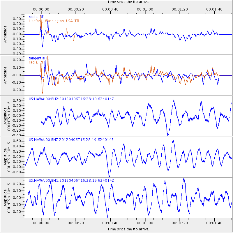
Signal To Noise
| Channel | StoN | STA | LTA |
| US:HAWA:00:BHZ:20120406T16:28:19.624014Z | 1.1718491 | 1.8627071E-7 | 1.5895452E-7 |
| US:HAWA:00:BH1:20120406T16:28:19.624014Z | 1.3927175 | 1.296501E-7 | 9.3091465E-8 |
| US:HAWA:00:BH2:20120406T16:28:19.624014Z | 0.8342592 | 7.5861465E-8 | 9.093273E-8 |
| Arrivals |
| Ps | |
| PpPs | |
| PsPs/PpSs | |


