You are here: Home > Network List > US - United States National Seismic Network Stations List
> Station MIAR Mount Ida, Arkansas, USA > Earthquake Result Viewer
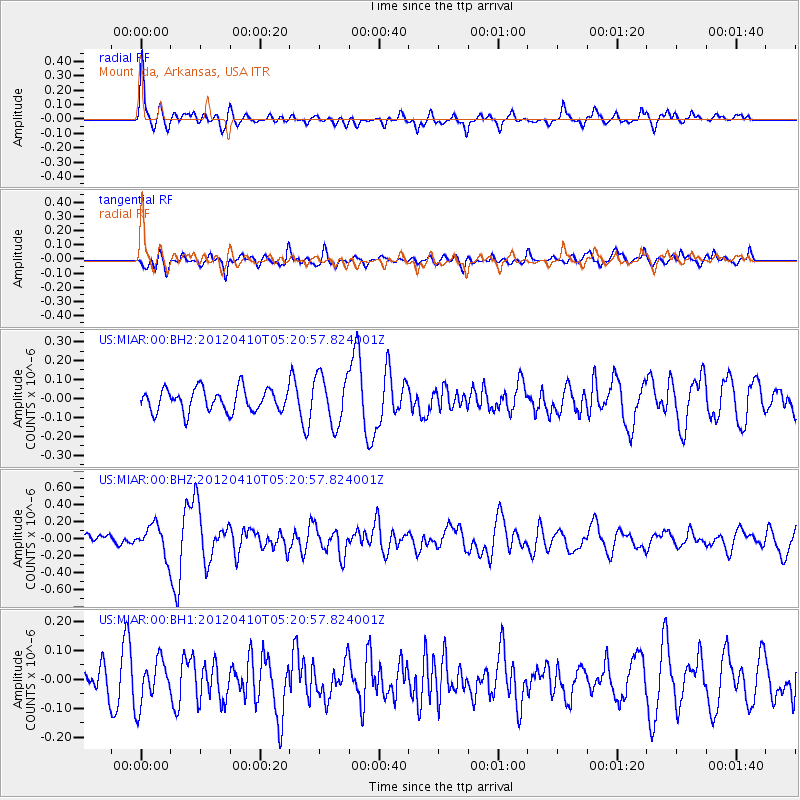
MIAR Mount Ida, Arkansas, USA - Earthquake Result Viewer
*The percent match for this event was below the threshold and hence no stack was calculated.
| Earthquake location: |
North Of Ascension Island |
| Earthquake latitude/longitude: |
-1.3/-14.0 |
| Earthquake time(UTC): |
2012/04/10 (101) 05:09:08 GMT |
| Earthquake Depth: |
10 km |
| Earthquake Magnitude: |
5.8 MW, 5.4 MS, 5.4 MB, 5.8 MW |
| Earthquake Catalog/Contributor: |
WHDF/NEIC |
|
| Network: |
US United States National Seismic Network |
| Station: |
MIAR Mount Ida, Arkansas, USA |
| Lat/Lon: |
34.55 N/93.58 W |
| Elevation: |
207 m |
|
| Distance: |
82.2 deg |
| Az: |
304.957 deg |
| Baz: |
96.95 deg |
| Ray Param: |
$rayparam |
*The percent match for this event was below the threshold and hence was not used in the summary stack. |
|
| Radial Match: |
66.29518 % |
| Radial Bump: |
368 |
| Transverse Match: |
63.294052 % |
| Transverse Bump: |
400 |
| SOD ConfigId: |
558545 |
| Insert Time: |
2013-09-19 15:15:01.053 +0000 |
| GWidth: |
2.5 |
| Max Bumps: |
400 |
| Tol: |
0.001 |
|
Signal To Noise
| Channel | StoN | STA | LTA |
| US:MIAR:00:BHZ:20120410T05:20:57.824001Z | 2.2449262 | 1.7734013E-7 | 7.899597E-8 |
| US:MIAR:00:BH1:20120410T05:20:57.824001Z | 1.6941507 | 7.603689E-8 | 4.488201E-8 |
| US:MIAR:00:BH2:20120410T05:20:57.824001Z | 2.1653605 | 1.2979797E-7 | 5.99429E-8 |
| Arrivals |
| Ps | |
| PpPs | |
| PsPs/PpSs | |


