ABPO Ambohimpanompo, Madagascar - Earthquake Result Viewer
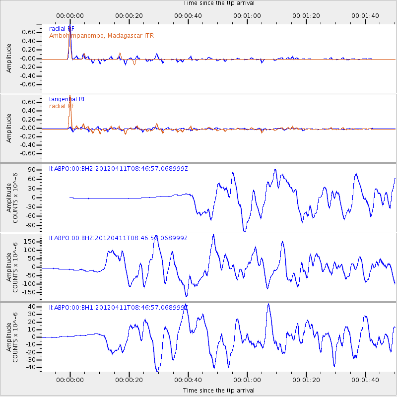
Earthquake location: Off W Coast Of Northern Sumatra
Earthquake latitude/longitude: 2.3/93.1
Earthquake time(UTC): 2012/04/11 (102) 08:38:36 GMT
Earthquake Depth: 20 km
Earthquake Magnitude: 7.4 MB, 8.5 MS, 8.6 MW, 8.6 MW
Earthquake Catalog/Contributor: WHDF/NEIC
Network: II Global Seismograph Network (GSN - IRIS/IDA)
Station: ABPO Ambohimpanompo, Madagascar
Lat/Lon: 19.02 S/47.23 E
Elevation: 1528 m
Distance: 49.8 deg
Az: 242.703 deg
Baz: 69.804 deg
Ray Param: 0.06845103
Estimated Moho Depth: 35.5 km
Estimated Crust Vp/Vs: 1.82
Assumed Crust Vp: 6.642 km/s
Estimated Crust Vs: 3.644 km/s
Estimated Crust Poisson's Ratio: 0.28
Radial Match: 98.60969 %
Radial Bump: 178
Transverse Match: 91.48446 %
Transverse Bump: 400
SOD ConfigId: 558545
Insert Time: 2013-09-19 15:16:19.543 +0000
GWidth: 2.5
Max Bumps: 400
Tol: 0.001

Signal To Noise

ChannelStoNSTALTA
II:ABPO:00:BHZ:20120411T08:46:57.068999Z8.710281.0809687E-51.2410263E-6
II:ABPO:00:BH1:20120411T08:46:57.068999Z3.77744032.2808606E-66.038112E-7
II:ABPO:00:BH2:20120411T08:46:57.068999Z7.75840956.8941213E-68.8859986E-7
Arrivals
Ps4.7 SECOND
PpPs14 SECOND
PsPs/PpSs19 SECOND