NIL Nilore, Pakistan - Earthquake Result Viewer
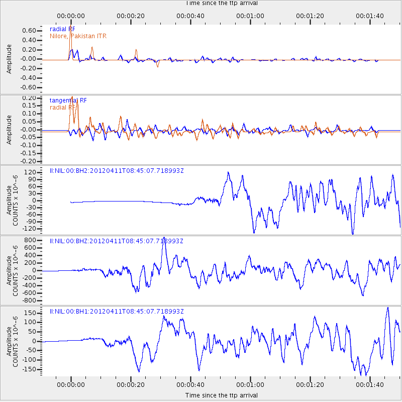
Earthquake location: Off W Coast Of Northern Sumatra
Earthquake latitude/longitude: 2.3/93.1
Earthquake time(UTC): 2012/04/11 (102) 08:38:36 GMT
Earthquake Depth: 20 km
Earthquake Magnitude: 7.4 MB, 8.5 MS, 8.6 MW, 8.6 MW
Earthquake Catalog/Contributor: WHDF/NEIC
Network: II Global Seismograph Network (GSN - IRIS/IDA)
Station: NIL Nilore, Pakistan
Lat/Lon: 33.65 N/73.27 E
Elevation: 629 m
Distance: 36.2 deg
Az: 331.462 deg
Baz: 145.092 deg
Ray Param: 0.07675951
Estimated Moho Depth: 19.25 km
Estimated Crust Vp/Vs: 1.69
Assumed Crust Vp: 6.242 km/s
Estimated Crust Vs: 3.693 km/s
Estimated Crust Poisson's Ratio: 0.23
Radial Match: 92.550674 %
Radial Bump: 330
Transverse Match: 81.62643 %
Transverse Bump: 400
SOD ConfigId: 558545
Insert Time: 2013-09-19 15:16:30.867 +0000
GWidth: 2.5
Max Bumps: 400
Tol: 0.001

Signal To Noise

ChannelStoNSTALTA
II:NIL:00:BHZ:20120411T08:45:07.718993Z8.4968393.0357185E-53.5727624E-6
II:NIL:00:BH1:20120411T08:45:07.718993Z4.0203827.442843E-61.8512776E-6
II:NIL:00:BH2:20120411T08:45:07.718993Z3.05050855.9829486E-61.9612955E-6
Arrivals
Ps2.3 SECOND
PpPs7.7 SECOND
PsPs/PpSs10.0 SECOND