
KEV Kevo, Finland - Earthquake Result Viewer
| ||||||||||||||||||
| ||||||||||||||||||
| ||||||||||||||||||
|
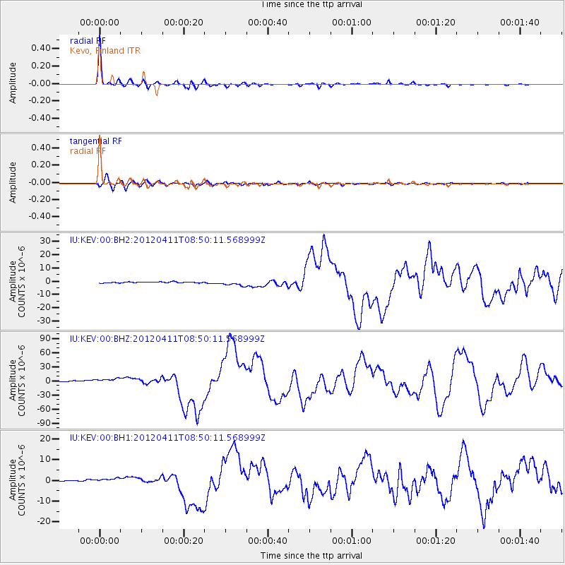
Signal To Noise
| Channel | StoN | STA | LTA |
| IU:KEV:00:BHZ:20120411T08:50:11.568999Z | 6.4197493 | 4.462253E-6 | 6.950821E-7 |
| IU:KEV:00:BH1:20120411T08:50:11.568999Z | 3.454153 | 9.546383E-7 | 2.7637407E-7 |
| IU:KEV:00:BH2:20120411T08:50:11.568999Z | 5.369184 | 2.0206276E-6 | 3.7633794E-7 |
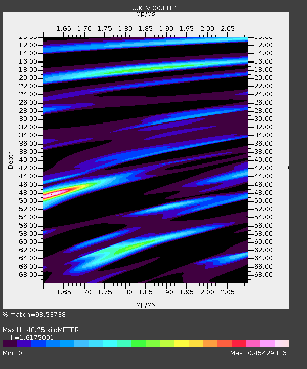
| Arrivals | |
| Ps | 4.7 SECOND |
| PpPs | 18 SECOND |
| PsPs/PpSs | 23 SECOND |

