MAJO Matsushiro, Japan - Earthquake Result Viewer
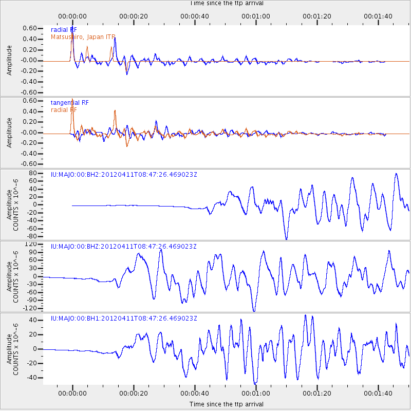
Earthquake location: Off W Coast Of Northern Sumatra
Earthquake latitude/longitude: 2.3/93.1
Earthquake time(UTC): 2012/04/11 (102) 08:38:36 GMT
Earthquake Depth: 20 km
Earthquake Magnitude: 7.4 MB, 8.5 MS, 8.6 MW, 8.6 MW
Earthquake Catalog/Contributor: WHDF/NEIC
Network: IU Global Seismograph Network (GSN - IRIS/USGS)
Station: MAJO Matsushiro, Japan
Lat/Lon: 36.55 N/138.20 E
Elevation: 405 m
Distance: 53.7 deg
Az: 45.067 deg
Baz: 241.449 deg
Ray Param: 0.065873474
Estimated Moho Depth: 33.75 km
Estimated Crust Vp/Vs: 1.81
Assumed Crust Vp: 6.461 km/s
Estimated Crust Vs: 3.575 km/s
Estimated Crust Poisson's Ratio: 0.28
Radial Match: 97.08279 %
Radial Bump: 400
Transverse Match: 89.818756 %
Transverse Bump: 400
SOD ConfigId: 558545
Insert Time: 2013-09-19 15:17:08.524 +0000
GWidth: 2.5
Max Bumps: 400
Tol: 0.001

Signal To Noise

ChannelStoNSTALTA
IU:MAJO:00:BHZ:20120411T08:47:26.469023Z7.24016954.8593483E-66.71165E-7
IU:MAJO:00:BH1:20120411T08:47:26.469023Z4.2630071.386536E-63.2524838E-7
IU:MAJO:00:BH2:20120411T08:47:26.469023Z6.12935452.2413228E-63.656703E-7
Arrivals
Ps4.4 SECOND
PpPs14 SECOND
PsPs/PpSs18 SECOND