You are here: Home > Network List > IU - Global Seismograph Network (GSN - IRIS/USGS) Stations List
> Station HNR Honiara, Solomon Islands > Earthquake Result Viewer
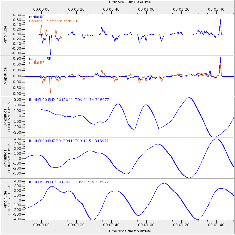
HNR Honiara, Solomon Islands - Earthquake Result Viewer
*The percent match for this event was below the threshold and hence no stack was calculated.
| Earthquake location: |
North Indian Ocean |
| Earthquake latitude/longitude: |
2.2/89.4 |
| Earthquake time(UTC): |
2012/04/11 (102) 09:01:06 GMT |
| Earthquake Depth: |
10 km |
| Earthquake Magnitude: |
5.9 MB |
| Earthquake Catalog/Contributor: |
WHDF/NEIC |
|
| Network: |
IU Global Seismograph Network (GSN - IRIS/USGS) |
| Station: |
HNR Honiara, Solomon Islands |
| Lat/Lon: |
9.44 S/159.95 E |
| Elevation: |
100 m |
|
| Distance: |
71.2 deg |
| Az: |
100.677 deg |
| Baz: |
275.574 deg |
| Ray Param: |
$rayparam |
*The percent match for this event was below the threshold and hence was not used in the summary stack. |
|
| Radial Match: |
75.93514 % |
| Radial Bump: |
346 |
| Transverse Match: |
43.443005 % |
| Transverse Bump: |
400 |
| SOD ConfigId: |
558545 |
| Insert Time: |
2013-09-19 15:24:31.821 +0000 |
| GWidth: |
2.5 |
| Max Bumps: |
400 |
| Tol: |
0.001 |
|
Signal To Noise
| Channel | StoN | STA | LTA |
| IU:HNR:00:BHZ:20120411T09:11:54.31897Z | 0.84110063 | 7.036094E-5 | 8.365342E-5 |
| IU:HNR:00:BH1:20120411T09:11:54.31897Z | 2.834426 | 2.4590315E-4 | 8.675589E-5 |
| IU:HNR:00:BH2:20120411T09:11:54.31897Z | 3.6294317 | 1.5629485E-4 | 4.3063174E-5 |
| Arrivals |
| Ps | |
| PpPs | |
| PsPs/PpSs | |


