You are here: Home > Network List > II - Global Seismograph Network (GSN - IRIS/IDA) Stations List
> Station WRAB Tennant Creek, NT, Australia > Earthquake Result Viewer
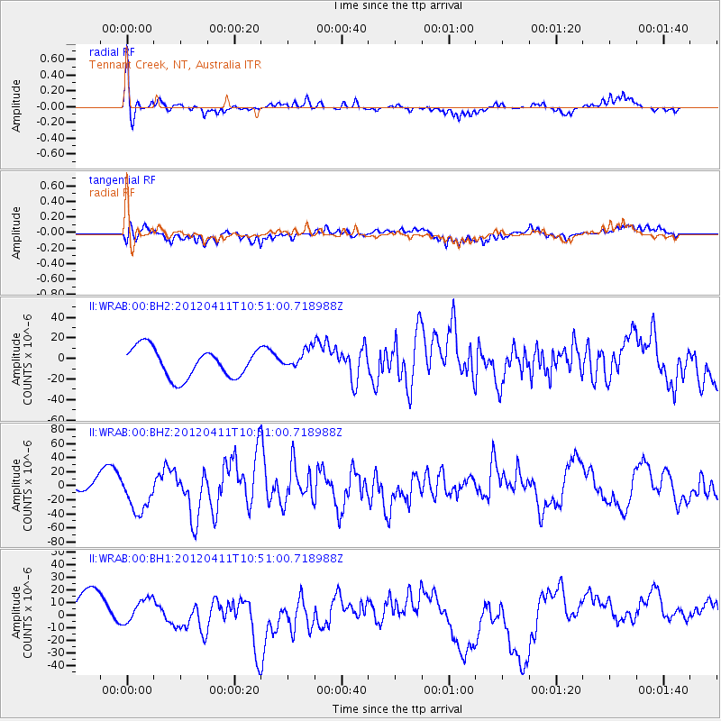
WRAB Tennant Creek, NT, Australia - Earthquake Result Viewer
*The percent match for this event was below the threshold and hence no stack was calculated.
| Earthquake location: |
Off W Coast Of Northern Sumatra |
| Earthquake latitude/longitude: |
0.8/92.5 |
| Earthquake time(UTC): |
2012/04/11 (102) 10:43:10 GMT |
| Earthquake Depth: |
25 km |
| Earthquake Magnitude: |
7.2 MB, 8.2 MW, 8.2 MW |
| Earthquake Catalog/Contributor: |
WHDF/NEIC |
|
| Network: |
II Global Seismograph Network (GSN - IRIS/IDA) |
| Station: |
WRAB Tennant Creek, NT, Australia |
| Lat/Lon: |
19.93 S/134.36 E |
| Elevation: |
366 m |
|
| Distance: |
45.9 deg |
| Az: |
119.025 deg |
| Baz: |
291.671 deg |
| Ray Param: |
$rayparam |
*The percent match for this event was below the threshold and hence was not used in the summary stack. |
|
| Radial Match: |
72.35252 % |
| Radial Bump: |
301 |
| Transverse Match: |
56.8853 % |
| Transverse Bump: |
400 |
| SOD ConfigId: |
558545 |
| Insert Time: |
2013-09-19 15:27:41.611 +0000 |
| GWidth: |
2.5 |
| Max Bumps: |
400 |
| Tol: |
0.001 |
|
Signal To Noise
| Channel | StoN | STA | LTA |
| II:WRAB:00:BHZ:20120411T10:51:00.718988Z | 3.7536461 | 2.6723777E-5 | 7.1194186E-6 |
| II:WRAB:00:BH1:20120411T10:51:00.718988Z | 0.7428948 | 1.2763307E-5 | 1.7180502E-5 |
| II:WRAB:00:BH2:20120411T10:51:00.718988Z | 0.68060195 | 9.641611E-6 | 1.4166299E-5 |
| Arrivals |
| Ps | |
| PpPs | |
| PsPs/PpSs | |


