You are here: Home > Network List > IU - Global Seismograph Network (GSN - IRIS/USGS) Stations List
> Station PMG Port Moresby, New Guinea > Earthquake Result Viewer
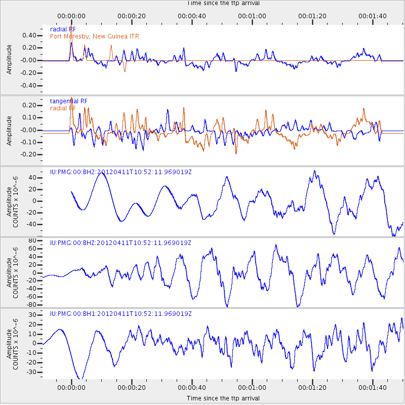
PMG Port Moresby, New Guinea - Earthquake Result Viewer
*The percent match for this event was below the threshold and hence no stack was calculated.
| Earthquake location: |
Off W Coast Of Northern Sumatra |
| Earthquake latitude/longitude: |
0.8/92.5 |
| Earthquake time(UTC): |
2012/04/11 (102) 10:43:10 GMT |
| Earthquake Depth: |
25 km |
| Earthquake Magnitude: |
7.2 MB, 8.2 MW, 8.2 MW |
| Earthquake Catalog/Contributor: |
WHDF/NEIC |
|
| Network: |
IU Global Seismograph Network (GSN - IRIS/USGS) |
| Station: |
PMG Port Moresby, New Guinea |
| Lat/Lon: |
9.40 S/147.16 E |
| Elevation: |
90 m |
|
| Distance: |
55.4 deg |
| Az: |
101.938 deg |
| Baz: |
277.507 deg |
| Ray Param: |
$rayparam |
*The percent match for this event was below the threshold and hence was not used in the summary stack. |
|
| Radial Match: |
55.645992 % |
| Radial Bump: |
400 |
| Transverse Match: |
52.624084 % |
| Transverse Bump: |
400 |
| SOD ConfigId: |
558545 |
| Insert Time: |
2013-09-19 15:28:13.289 +0000 |
| GWidth: |
2.5 |
| Max Bumps: |
400 |
| Tol: |
0.001 |
|
Signal To Noise
| Channel | StoN | STA | LTA |
| IU:PMG:00:BHZ:20120411T10:52:11.969019Z | 0.4019184 | 6.2980707E-6 | 1.5670023E-5 |
| IU:PMG:00:BH1:20120411T10:52:11.969019Z | 4.256218 | 3.4916924E-5 | 8.203744E-6 |
| IU:PMG:00:BH2:20120411T10:52:11.969019Z | 0.7431939 | 1.7709552E-5 | 2.3828978E-5 |
| Arrivals |
| Ps | |
| PpPs | |
| PsPs/PpSs | |


