You are here: Home > Network List > IU - Global Seismograph Network (GSN - IRIS/USGS) Stations List
> Station PMG Port Moresby, New Guinea > Earthquake Result Viewer
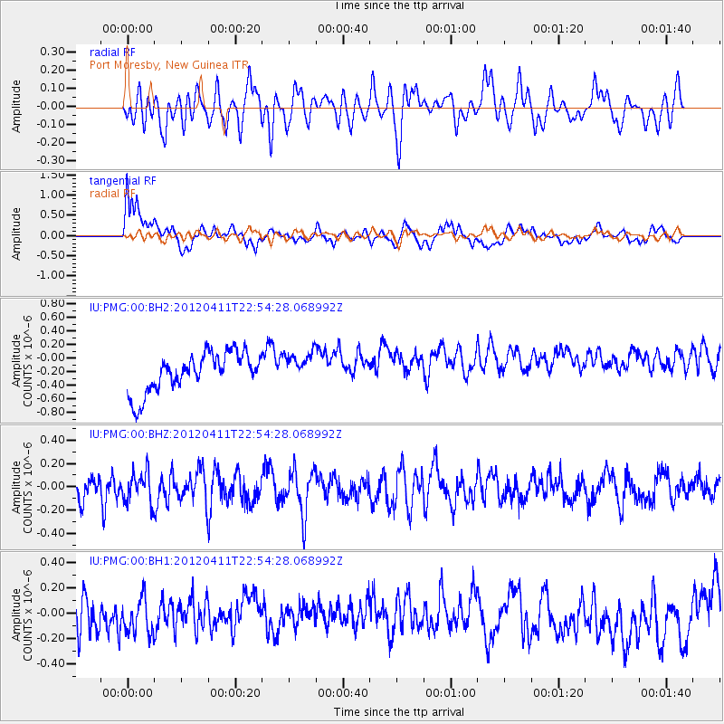
PMG Port Moresby, New Guinea - Earthquake Result Viewer
*The percent match for this event was below the threshold and hence no stack was calculated.
| Earthquake location: |
Off Coast Of Oregon |
| Earthquake latitude/longitude: |
43.6/-127.6 |
| Earthquake time(UTC): |
2012/04/11 (102) 22:41:46 GMT |
| Earthquake Depth: |
8.0 km |
| Earthquake Magnitude: |
5.8 MB, 5.9 MS, 6.0 MW |
| Earthquake Catalog/Contributor: |
WHDF/NEIC |
|
| Network: |
IU Global Seismograph Network (GSN - IRIS/USGS) |
| Station: |
PMG Port Moresby, New Guinea |
| Lat/Lon: |
9.40 S/147.16 E |
| Elevation: |
90 m |
|
| Distance: |
93.0 deg |
| Az: |
259.927 deg |
| Baz: |
46.476 deg |
| Ray Param: |
$rayparam |
*The percent match for this event was below the threshold and hence was not used in the summary stack. |
|
| Radial Match: |
38.333023 % |
| Radial Bump: |
400 |
| Transverse Match: |
71.73344 % |
| Transverse Bump: |
400 |
| SOD ConfigId: |
558545 |
| Insert Time: |
2013-09-19 15:34:59.942 +0000 |
| GWidth: |
2.5 |
| Max Bumps: |
400 |
| Tol: |
0.001 |
|
Signal To Noise
| Channel | StoN | STA | LTA |
| IU:PMG:00:BHZ:20120411T22:54:28.068992Z | 1.0085163 | 1.4638555E-7 | 1.451494E-7 |
| IU:PMG:00:BH1:20120411T22:54:28.068992Z | 0.92644334 | 2.3552833E-7 | 2.5422852E-7 |
| IU:PMG:00:BH2:20120411T22:54:28.068992Z | 0.78812814 | 2.2475781E-7 | 2.8517928E-7 |
| Arrivals |
| Ps | |
| PpPs | |
| PsPs/PpSs | |


