You are here: Home > Network List > II - Global Seismograph Network (GSN - IRIS/IDA) Stations List
> Station WRAB Tennant Creek, NT, Australia > Earthquake Result Viewer
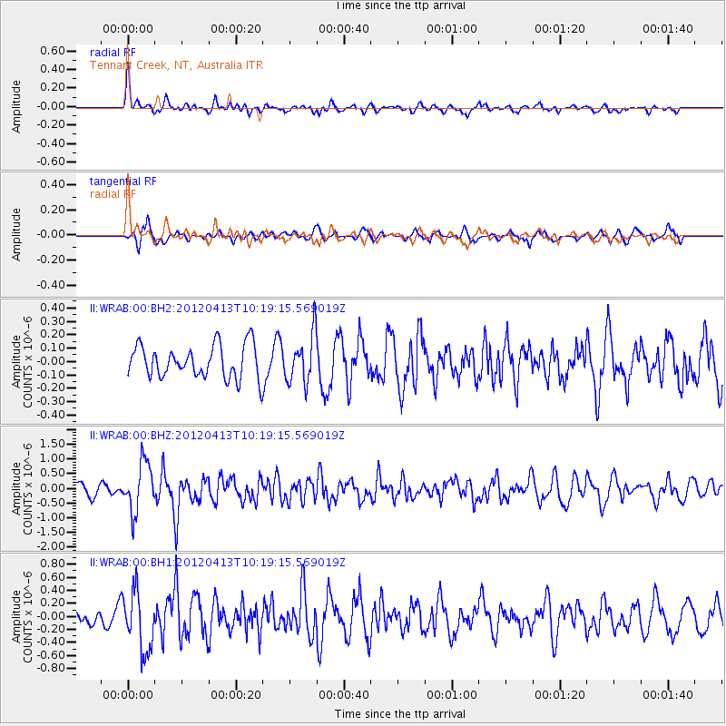
WRAB Tennant Creek, NT, Australia - Earthquake Result Viewer
*The percent match for this event was below the threshold and hence no stack was calculated.
| Earthquake location: |
Near East Coast Of Honshu, Japan |
| Earthquake latitude/longitude: |
37.0/141.2 |
| Earthquake time(UTC): |
2012/04/13 (104) 10:10:01 GMT |
| Earthquake Depth: |
11 km |
| Earthquake Magnitude: |
5.6 MB, 5.4 MS, 5.7 MW, 5.7 MW |
| Earthquake Catalog/Contributor: |
WHDF/NEIC |
|
| Network: |
II Global Seismograph Network (GSN - IRIS/IDA) |
| Station: |
WRAB Tennant Creek, NT, Australia |
| Lat/Lon: |
19.93 S/134.36 E |
| Elevation: |
366 m |
|
| Distance: |
57.0 deg |
| Az: |
187.626 deg |
| Baz: |
6.485 deg |
| Ray Param: |
$rayparam |
*The percent match for this event was below the threshold and hence was not used in the summary stack. |
|
| Radial Match: |
59.544052 % |
| Radial Bump: |
359 |
| Transverse Match: |
49.605915 % |
| Transverse Bump: |
369 |
| SOD ConfigId: |
558545 |
| Insert Time: |
2013-09-19 15:51:31.607 +0000 |
| GWidth: |
2.5 |
| Max Bumps: |
400 |
| Tol: |
0.001 |
|
Signal To Noise
| Channel | StoN | STA | LTA |
| II:WRAB:00:BHZ:20120413T10:19:15.569019Z | 3.6199577 | 8.4680835E-7 | 2.339277E-7 |
| II:WRAB:00:BH1:20120413T10:19:15.569019Z | 3.4999094 | 4.567013E-7 | 1.3048945E-7 |
| II:WRAB:00:BH2:20120413T10:19:15.569019Z | 1.5029142 | 1.8265509E-7 | 1.2153394E-7 |
| Arrivals |
| Ps | |
| PpPs | |
| PsPs/PpSs | |


