PMB Pemberton, British Columbia, Canada - Earthquake Result Viewer
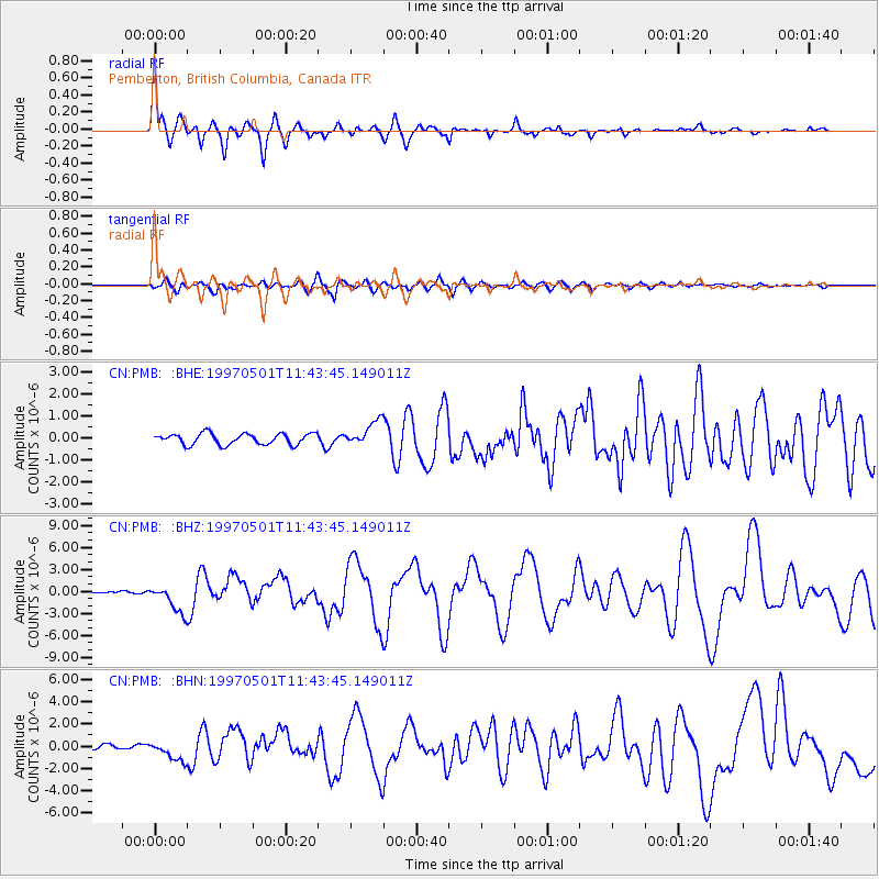
Earthquake location: Off Coast Of Jalisco, Mexico
Earthquake latitude/longitude: 19.0/-107.3
Earthquake time(UTC): 1997/05/01 (121) 11:37:36 GMT
Earthquake Depth: 33 km
Earthquake Magnitude: 6.1 MB, 6.8 MS, 7.1 UNKNOWN, 7.1 ME
Earthquake Catalog/Contributor: WHDF/NEIC
Network: CN Canadian National Seismograph Network
Station: PMB Pemberton, British Columbia, Canada
Lat/Lon: 50.52 N/123.08 W
Elevation: 400 m
Distance: 33.9 deg
Az: 341.906 deg
Baz: 152.59 deg
Ray Param: 0.07796198
Estimated Moho Depth: 29.5 km
Estimated Crust Vp/Vs: 1.93
Assumed Crust Vp: 6.566 km/s
Estimated Crust Vs: 3.402 km/s
Estimated Crust Poisson's Ratio: 0.32
Radial Match: 89.111755 %
Radial Bump: 400
Transverse Match: 71.992966 %
Transverse Bump: 400
SOD ConfigId: 4480
Insert Time: 2010-02-27 06:51:20.507 +0000
GWidth: 2.5
Max Bumps: 400
Tol: 0.001

Signal To Noise

ChannelStoNSTALTA
CN:PMB: :BHZ:19970501T11:43:45.149011Z7.15001251.896807E-62.6528724E-7
CN:PMB: :BHN:19970501T11:43:45.149011Z5.78830968.9371827E-71.5440057E-7
CN:PMB: :BHE:19970501T11:43:45.149011Z2.21283225.570322E-72.5172818E-7
Arrivals
Ps4.5 SECOND
PpPs12 SECOND
PsPs/PpSs17 SECOND