You are here: Home > Network List > II - Global Seismograph Network (GSN - IRIS/IDA) Stations List
> Station CMLA Cha de Macela, Sao Miguel Island, Azores > Earthquake Result Viewer
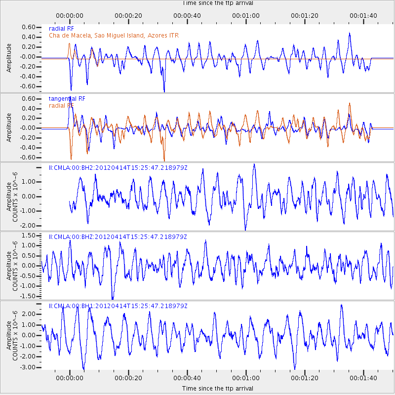
CMLA Cha de Macela, Sao Miguel Island, Azores - Earthquake Result Viewer
*The percent match for this event was below the threshold and hence no stack was calculated.
| Earthquake location: |
Kuril Islands |
| Earthquake latitude/longitude: |
49.4/155.7 |
| Earthquake time(UTC): |
2012/04/14 (105) 15:13:14 GMT |
| Earthquake Depth: |
90 km |
| Earthquake Magnitude: |
5.6 MW, 5.6 MW |
| Earthquake Catalog/Contributor: |
NEIC PDE/NEIC PDE-M |
|
| Network: |
II Global Seismograph Network (GSN - IRIS/IDA) |
| Station: |
CMLA Cha de Macela, Sao Miguel Island, Azores |
| Lat/Lon: |
37.76 N/25.52 W |
| Elevation: |
429 m |
|
| Distance: |
93.2 deg |
| Az: |
0.933 deg |
| Baz: |
359.231 deg |
| Ray Param: |
$rayparam |
*The percent match for this event was below the threshold and hence was not used in the summary stack. |
|
| Radial Match: |
45.861176 % |
| Radial Bump: |
400 |
| Transverse Match: |
52.579124 % |
| Transverse Bump: |
400 |
| SOD ConfigId: |
558545 |
| Insert Time: |
2013-09-19 15:58:47.378 +0000 |
| GWidth: |
2.5 |
| Max Bumps: |
400 |
| Tol: |
0.001 |
|
Signal To Noise
| Channel | StoN | STA | LTA |
| II:CMLA:00:BHZ:20120414T15:25:47.218979Z | 1.164193 | 4.801696E-7 | 4.124485E-7 |
| II:CMLA:00:BH1:20120414T15:25:47.218979Z | 2.4535944 | 1.6960546E-6 | 6.912531E-7 |
| II:CMLA:00:BH2:20120414T15:25:47.218979Z | 1.2266275 | 7.760038E-7 | 6.32632E-7 |
| Arrivals |
| Ps | |
| PpPs | |
| PsPs/PpSs | |


