PMB Pemberton, British Columbia, Canada - Earthquake Result Viewer
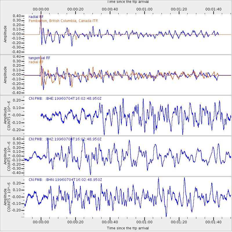
Earthquake location: W. Caroline Islands, Micronesia
Earthquake latitude/longitude: 8.5/141.6
Earthquake time(UTC): 1996/07/04 (186) 15:50:38 GMT
Earthquake Depth: 33 km
Earthquake Magnitude: 5.1 MB, 5.4 MS, 6.0 UNKNOWN, 5.9 MW
Earthquake Catalog/Contributor: WHDF/NEIC
Network: CN Canadian National Seismograph Network
Station: PMB Pemberton, British Columbia, Canada
Lat/Lon: 50.52 N/123.08 W
Elevation: 400 m
Distance: 86.9 deg
Az: 39.531 deg
Baz: 279.496 deg
Ray Param: 0.043664202
Estimated Moho Depth: 14.25 km
Estimated Crust Vp/Vs: 1.64
Assumed Crust Vp: 6.566 km/s
Estimated Crust Vs: 4.01 km/s
Estimated Crust Poisson's Ratio: 0.20
Radial Match: 83.83738 %
Radial Bump: 400
Transverse Match: 57.60738 %
Transverse Bump: 400
SOD ConfigId: 4480
Insert Time: 2010-02-27 06:51:37.507 +0000
GWidth: 2.5
Max Bumps: 400
Tol: 0.001

Signal To Noise

ChannelStoNSTALTA
CN:PMB: :BHZ:19960704T16:02:48.950Z1.84081521.2676186E-76.886181E-8
CN:PMB: :BHN:19960704T16:02:48.950Z0.833780945.1961717E-86.232059E-8
CN:PMB: :BHE:19960704T16:02:48.950Z1.40629186.530818E-84.6439993E-8
Arrivals
Ps1.4 SECOND
PpPs5.6 SECOND
PsPs/PpSs7.0 SECOND