You are here: Home > Network List > II - Global Seismograph Network (GSN - IRIS/IDA) Stations List
> Station WRAB Tennant Creek, NT, Australia > Earthquake Result Viewer
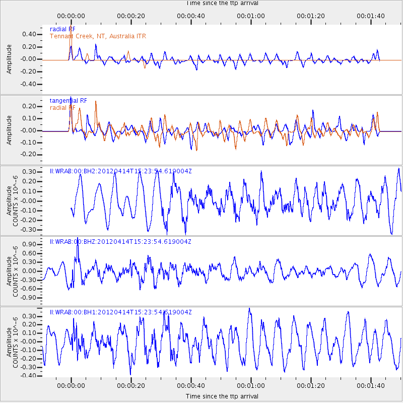
WRAB Tennant Creek, NT, Australia - Earthquake Result Viewer
*The percent match for this event was below the threshold and hence no stack was calculated.
| Earthquake location: |
Kuril Islands |
| Earthquake latitude/longitude: |
49.4/155.7 |
| Earthquake time(UTC): |
2012/04/14 (105) 15:13:14 GMT |
| Earthquake Depth: |
90 km |
| Earthquake Magnitude: |
5.6 MW, 5.6 MW |
| Earthquake Catalog/Contributor: |
NEIC PDE/NEIC PDE-M |
|
| Network: |
II Global Seismograph Network (GSN - IRIS/IDA) |
| Station: |
WRAB Tennant Creek, NT, Australia |
| Lat/Lon: |
19.93 S/134.36 E |
| Elevation: |
366 m |
|
| Distance: |
71.6 deg |
| Az: |
201.107 deg |
| Baz: |
14.487 deg |
| Ray Param: |
$rayparam |
*The percent match for this event was below the threshold and hence was not used in the summary stack. |
|
| Radial Match: |
76.863014 % |
| Radial Bump: |
400 |
| Transverse Match: |
60.40109 % |
| Transverse Bump: |
400 |
| SOD ConfigId: |
558545 |
| Insert Time: |
2013-09-19 15:59:09.405 +0000 |
| GWidth: |
2.5 |
| Max Bumps: |
400 |
| Tol: |
0.001 |
|
Signal To Noise
| Channel | StoN | STA | LTA |
| II:WRAB:00:BHZ:20120414T15:23:54.619004Z | 1.6563842 | 4.6655975E-7 | 2.8167364E-7 |
| II:WRAB:00:BH1:20120414T15:23:54.619004Z | 0.6917062 | 1.0794506E-7 | 1.5605623E-7 |
| II:WRAB:00:BH2:20120414T15:23:54.619004Z | 1.2473063 | 1.8859807E-7 | 1.5120429E-7 |
| Arrivals |
| Ps | |
| PpPs | |
| PsPs/PpSs | |


