PMB Pemberton, British Columbia, Canada - Earthquake Result Viewer
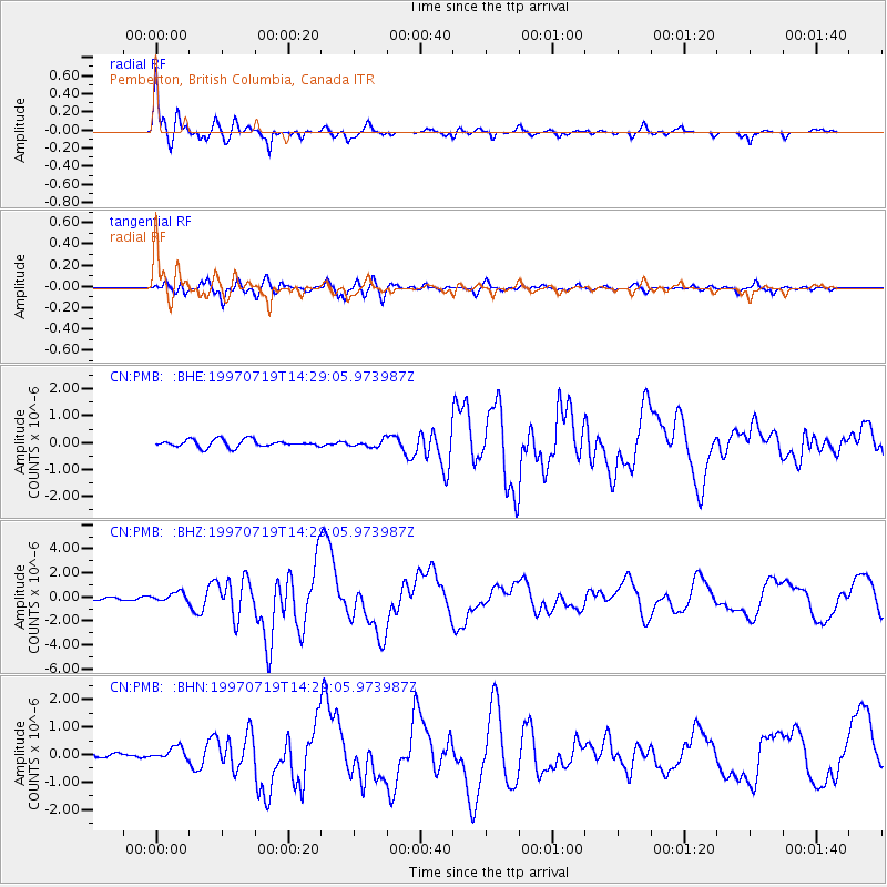
Earthquake location: Near Coast Of Guerrero, Mexico
Earthquake latitude/longitude: 16.3/-98.2
Earthquake time(UTC): 1997/07/19 (200) 14:22:08 GMT
Earthquake Depth: 33 km
Earthquake Magnitude: 5.7 MB, 6.3 MS, 6.8 UNKNOWN, 6.0 ME
Earthquake Catalog/Contributor: WHDF/NEIC
Network: CN Canadian National Seismograph Network
Station: PMB Pemberton, British Columbia, Canada
Lat/Lon: 50.52 N/123.08 W
Elevation: 400 m
Distance: 39.5 deg
Az: 335.062 deg
Baz: 140.642 deg
Ray Param: 0.07486628
Estimated Moho Depth: 37.25 km
Estimated Crust Vp/Vs: 1.60
Assumed Crust Vp: 6.566 km/s
Estimated Crust Vs: 4.104 km/s
Estimated Crust Poisson's Ratio: 0.18
Radial Match: 94.37026 %
Radial Bump: 400
Transverse Match: 76.311584 %
Transverse Bump: 400
SOD ConfigId: 4480
Insert Time: 2010-02-27 06:51:46.540 +0000
GWidth: 2.5
Max Bumps: 400
Tol: 0.001

Signal To Noise

ChannelStoNSTALTA
CN:PMB: :BHZ:19970719T14:29:05.973987Z4.36597254.0119804E-79.1892026E-8
CN:PMB: :BHN:19970719T14:29:05.973987Z2.42946272.2882143E-79.418602E-8
CN:PMB: :BHE:19970719T14:29:05.973987Z0.935533641.2870836E-71.3757749E-7
Arrivals
Ps3.7 SECOND
PpPs14 SECOND
PsPs/PpSs17 SECOND