You are here: Home > Network List > US - United States National Seismic Network Stations List
> Station MNTX Cornudas Mountains, Texas, USA > Earthquake Result Viewer
MNTX Cornudas Mountains, Texas, USA - Earthquake Result Viewer
*The percent match for this event was below the threshold and hence no stack was calculated.
| Earthquake location: |
Kuril Islands |
| Earthquake latitude/longitude: |
49.4/155.7 |
| Earthquake time(UTC): |
2012/04/14 (105) 15:13:14 GMT |
| Earthquake Depth: |
90 km |
| Earthquake Magnitude: |
5.6 MW, 5.6 MW |
| Earthquake Catalog/Contributor: |
NEIC PDE/NEIC PDE-M |
|
| Network: |
US United States National Seismic Network |
| Station: |
MNTX Cornudas Mountains, Texas, USA |
| Lat/Lon: |
31.70 N/105.38 W |
| Elevation: |
404 m |
|
| Distance: |
72.0 deg |
| Az: |
62.287 deg |
| Baz: |
317.252 deg |
| Ray Param: |
$rayparam |
*The percent match for this event was below the threshold and hence was not used in the summary stack. |
|
| Radial Match: |
47.058357 % |
| Radial Bump: |
400 |
| Transverse Match: |
67.5931 % |
| Transverse Bump: |
400 |
| SOD ConfigId: |
558545 |
| Insert Time: |
2013-09-19 16:01:25.663 +0000 |
| GWidth: |
2.5 |
| Max Bumps: |
400 |
| Tol: |
0.001 |
|
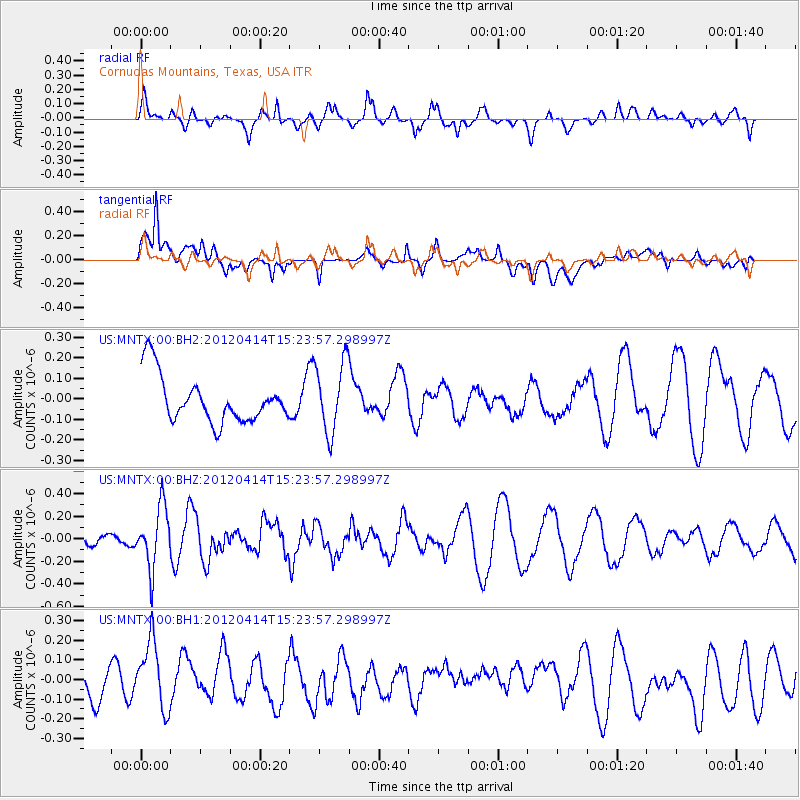
Signal To Noise
| Channel | StoN | STA | LTA |
| US:MNTX:00:BHZ:20120414T15:23:57.298997Z | 2.217276 | 2.6930016E-7 | 1.214554E-7 |
| US:MNTX:00:BH1:20120414T15:23:57.298997Z | 1.5982238 | 1.730762E-7 | 1.0829285E-7 |
| US:MNTX:00:BH2:20120414T15:23:57.298997Z | 1.5309176 | 1.7288126E-7 | 1.1292656E-7 |
| Arrivals |
| Ps | |
| PpPs | |
| PsPs/PpSs | |


